Kentucky - Bourbon County - Historic Districts
Bourbon County Kentucky (Historic Districts) has 14 places on the National Register of Historic Places including 1 place of Statewide significance. Significant places include Paris Courthouse Square Historic District, Aker, Jacob, Farm, Cane Ridge Rural Historic District, Champ, Thomas, House and Cooper's Run Rural Historic District.

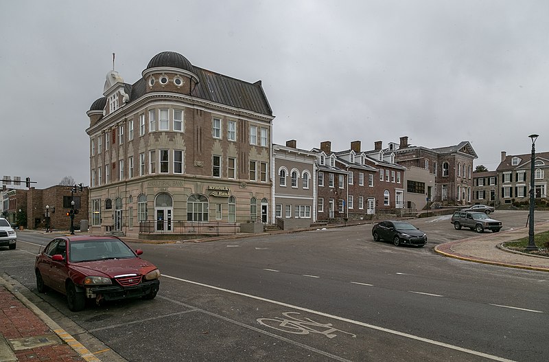
Several famous people are associated with these Bourbon County historic places including Brutus Clay, Gov. James et al. Garrad, Barton W. Stone and Barton Stone.

Some of the country's most noteable architects helped create the Bourbon County places including John Giltner, Combs Lumber Co., Jens Jensen, Thornton Anderson, John Metcalfe and Frank Milburn. Prominent architectural styles found in Bourbon Country are Federal, Classical Revival and Greek Revival.

Aker, Jacob, Farm (added 1993 - - #93000050)
Also known as BB-523;Clearwell Farm
795 Bethlehem Rd. , Paris
send us a photo to share
Historic Significance:
Architecture/Engineering
Architect, builder, or engineer:
Giltner, John
Architectural Style:
Greek Revival, Federal
Area of Significance:
Architecture
Period of Significance:
1850-1874, 1825-1849, 1800-1824
Owner:
Private
Historic Function:
Domestic, Funerary, Industry/Processing/Extraction
Historic Sub-function:
Cemetery, Extractive Facility, Secondary Structure, Single Dwelling
Current Function:
Domestic, Funerary
Current Sub-function:
Cemetery, Single Dwelling
Cane Ridge Rural Historic District (added 2003 - - #02001463)
Canal Ridge Rd. , Paris
KudzuVine, Public domain, via Wikimedia Commons
Historic Significance:
Event, Person, Architecture/Engineering
Architectural Style:
Federal, Classical Revival
Historic Person:
Stone, Barton
Significant Year:
1801, 1841, 1953
Area of Significance:
Religion, Social History, Agriculture
Period of Significance:
1950-1974, 1925-1949, 1900-1924, 1875-1899, 1850-1874, 1825-1849, 1800-1824, 1750-1799
Owner:
Private
Historic Function:
Agriculture/Subsistence, Domestic, Religion
Historic Sub-function:
Agricultural Outbuildings, Religious Structure, Single Dwelling
Current Function:
Agriculture/Subsistence, Domestic, Religion
Current Sub-function:
Agricultural Outbuildings, Religious Structure, Single Dwelling
Champ, Thomas, House (added 2003 - - #03000256)
Also known as Sulpher Spring Farm, Long Champ Farm
Lexington and Maysville Rd. , Paris
Christopher L. Riley, CC BY-SA 4.0, via Wikimedia Commons
Historic Significance:
Architecture/Engineering
Architectural Style:
Federal
Area of Significance:
Architecture
Period of Significance:
1825-1849
Owner:
Private
Historic Function:
Domestic, Funerary
Historic Sub-function:
Cemetery, Hotel, Single Dwelling
Current Function:
Domestic, Funerary
Current Sub-function:
Cemetery, Single Dwelling
Cooper's Run Rural Historic District (added 1998 - - #98001493)
Roughly along and included within Clay Kiser Rd., Paris-Cynthiana Rd., and US 460 , Paris
Nyttend, Public domain, via Wikimedia Commons
Historic Significance:
Person, Event
Historic Person:
Garrad, Gov. James et al.
Area of Significance:
Social History, Agriculture, Economics
Period of Significance:
1925-1949, 1900-1924, 1875-1899, 1850-1874, 1825-1849, 1800-1824, 1750-1799
Owner:
Private
Historic Function:
Agriculture/Subsistence, Domestic, Funerary, Religion
Historic Sub-function:
Agricultural Fields, Agricultural Outbuildings, Cemetery, Processing, Religious Structure, Single Dwelling
Current Function:
Agriculture/Subsistence, Domestic
Current Sub-function:
Agricultural Fields, Agricultural Outbuildings, Processing, Single Dwelling
Downtown Paris Historic District (added 1989 - - #89002123)
Also known as See Also:Courthouse Square Historic District;Duncan Tavern;E
Roughly bounded by 2nd St., Pleasant St., Main St., High St., and 12th St. , Paris
Zaher.Kadour, CC BY-SA 3.0, via Wikimedia Commons
Historic Significance:
Architecture/Engineering
Architect, builder, or engineer:
Et al., Milburn,Frank
Architectural Style:
Romanesque, Queen Anne, Italianate
Area of Significance:
Architecture
Period of Significance:
1925-1949, 1900-1924, 1900-1750 AD
Owner:
State, Local, Private
Historic Function:
Commerce/Trade, Domestic, Government, Social, Transportation
Historic Sub-function:
Business, Department Store, Financial Institution, Single Dwelling, Warehouse
Current Function:
Commerce/Trade, Domestic, Government
Current Sub-function:
Business, Courthouse, Financial Institution, Multiple Dwelling, Professional, Single Dwelling
Duncan Avenue Historic District (added 1988 - - #88000902)
Duncan, Stoner, Vine, and Massie Sts. , Paris
Nyttend, Public domain, via Wikimedia Commons
Historic Significance:
Event, Architecture/Engineering
Architect, builder, or engineer:
Unknown
Architectural Style:
Romanesque, Queen Anne, Italianate
Area of Significance:
Community Planning And Development, Architecture
Period of Significance:
1900-1924, 1875-1899, 1850-1874, 1825-1849, 1800-1824
Owner:
Private
Historic Function:
Domestic
Historic Sub-function:
Single Dwelling
Current Function:
Domestic
Current Sub-function:
Secondary Structure, Single Dwelling
Hillside Farm (added 2000 - - #00000277)
Also known as Dodge Farm, BB-40
1165 N. Middletown Rd. , Paris
send us a photo to share
Historic Significance:
Event
Area of Significance:
Agriculture
Period of Significance:
1925-1949
Owner:
Private
Historic Function:
Agriculture/Subsistence, Domestic
Historic Sub-function:
Agricultural Fields, Animal Facility, Processing, Single Dwelling, Storage
Current Function:
Agriculture/Subsistence, Domestic
Current Sub-function:
Agricultural Fields, Animal Facility, Processing, Single Dwelling, Storage
Little Rock--Jackstown Road Rural Historic District (added 2004 - - #04000246)
Along Little Rock-Jackstown and Soper Rds. , Little Rock
Nyttend, Public domain, via Wikimedia Commons
Historic Significance:
Person, Event
Historic Person:
Stone, Barton W.
Significant Year:
1810, 1900, 1797
Area of Significance:
Social History, Agriculture, Religion
Period of Significance:
1950-1974, 1925-1949, 1900-1924, 1875-1899, 1850-1874, 1825-1849, 1800-1824, 1750-1799
Owner:
Private
Historic Function:
Agriculture/Subsistence, Domestic
Historic Sub-function:
Single Dwelling
Current Function:
Agriculture/Subsistence, Domestic
Current Sub-function:
Single Dwelling
Millersburg Historic District (added 1986 - - #86000697)
Roughly bounded by College Ave., Miller, Second, and Trigg Sts. , Millersburg
Christopher L. Riley, CC BY-SA 4.0, via Wikimedia Commons
Historic Significance:
Event, Architecture/Engineering
Architect, builder, or engineer:
Unknown
Architectural Style:
Mid 19th Century Revival, Bungalow/Craftsman, Late Victorian
Area of Significance:
Exploration/Settlement, Architecture, Commerce
Period of Significance:
1925-1949, 1900-1924, 1875-1899, 1850-1874, 1825-1849, 1800-1824
Owner:
Local, Private
Historic Function:
Commerce/Trade, Domestic, Education
Historic Sub-function:
College, Single Dwelling, Specialty Store
Current Function:
Commerce/Trade, Domestic, Education
Current Sub-function:
School, Single Dwelling, Specialty Store
Owen--Gay Farm (added 1997 - - #97000163)
Also known as CK-204;BB-362
Gay Rd., jct. with Donaldson Rd. at the Bourbon--Clark Co. line , Winchester
Nyttend, Public domain, via Wikimedia Commons
Historic Significance:
Event
Area of Significance:
Agriculture
Period of Significance:
1925-1949, 1900-1924, 1875-1899, 1850-1874, 1825-1849
Owner:
Private
Historic Function:
Agriculture/Subsistence, Domestic
Historic Sub-function:
Agricultural Fields, Animal Facility, Processing, Single Dwelling, Storage
Current Function:
Agriculture/Subsistence
Current Sub-function:
Agricultural Fields, Animal Facility, Storage
Paris Courthouse Square Historic District (added 1979 - - #79000963)
Also known as See Also:Bourbon County Courthouse;Duncan Tavern
Courthouse Sq. and environs , Paris
Christopher L. Riley, CC BY-SA 4.0, via Wikimedia Commons
Historic Significance:
Event, Architecture/Engineering
Architect, builder, or engineer:
Multiple
Architectural Style:
Italianate
Area of Significance:
Community Planning And Development, Commerce, Architecture
Period of Significance:
1875-1899, 1750-1799
Owner:
Local, Private
Historic Function:
Commerce/Trade, Domestic
Current Function:
Commerce/Trade, Domestic
Pocket Rural Historic District (added 2003 - - #03000257)
Along See Rd., KY 57 and KY 1198 , Sharpsburg
Nyttend, Public domain, via Wikimedia Commons
Historic Significance:
Event
Area of Significance:
Social History, Agriculture
Period of Significance:
1950-1974, 1925-1949, 1900-1924, 1875-1899, 1850-1874, 1825-1849, 1800-1824, 1750-1799
Owner:
Private
Historic Function:
Agriculture/Subsistence, Domestic
Historic Sub-function:
Single Dwelling
Current Function:
Agriculture/Subsistence, Domestic
Current Sub-function:
Single Dwelling
Stoner Creek Rural Historic District (added 2001 - - #01000449)
Along Winchester, Stoney Point, Spears Mill and N. Middletown Rds. , Paris
send us a photo to share
Historic Significance:
Event, Person
Historic Person:
Clay, Brutus
Significant Year:
1840, 1900
Area of Significance:
Economics, Politics/Government, Agriculture
Period of Significance:
1950-1974, 1925-1949, 1900-1924, 1875-1899, 1850-1874, 1825-1849
Owner:
Private, Local, State
Historic Function:
Agriculture/Subsistence, Commerce/Trade, Domestic, Recreation And Culture, Transportation
Historic Sub-function:
Multiple Dwelling, Processing, Road-Related, Single Dwelling, Sport Facility, Storage, Warehouse
Current Function:
Agriculture/Subsistence, Commerce/Trade, Domestic, Religion
Current Sub-function:
Agricultural Fields, Multiple Dwelling, Processing, Religious Structure, Single Dwelling, Storage, Warehouse
West Millersburg Rural Historic District (added 2007 - - #06001197)
Millersburg--Ruddels Mills Rd and Steele Ford Rd. , Millersburg
send us a photo to share
Historic Significance:
Event
Area of Significance:
Agriculture, Social History
Period of Significance:
1950-1974, 1925-1949, 1900-1924, 1875-1899, 1850-1874
Owner:
Private
Historic Function:
Agriculture/Subsistence, Domestic
Historic Sub-function:
Agricultural Fields, Agricultural Outbuildings, Processing, Single Dwelling, Storage
Current Function:
Agriculture/Subsistence, Domestic
Current Sub-function:
Agricultural Fields, Agricultural Outbuildings, Processing, Single Dwelling, Storage
Return to Top
Select a Different Kentucky County (map)
Adair
Allen
Anderson
Ballard
Barren
Bath
Bell
Boone
Bourbon
Boyd
Boyle
Bracken
Breathitt
Breckinridge
Bullitt
Butler
Caldwell
Calloway
Campbell
Carroll
Casey
Christian
Clark
Clay
Cumberland
Daviess
Edmonson
Estill
Fayette
Fleming
Floyd
Franklin
Fulton
Gallatin
Garrard
Graves
Grayson
Green
Greenup
Hancock
Hardin
Harlan
Harrison
Hart
Henderson
Henry
Hopkins
Jackson
Jefferson
Jessamine
Kenton
Knott
Knox
Larue
Laurel
Lawrence
Leslie
Letcher
Lewis
Lincoln
Livingston
Logan
Lyon
Madison
Marion
Marshall
Mason
McCracken
McCreary
Meade
Menifee
Mercer
Metcalfe
Montgomery
Muhlenberg
Nelson
Nicholas
Ohio
Oldham
Owen
Pendleton
Pike
Powell
Pulaski
Rockcastle
Rowan
Scott
Shelby
Simpson
Spencer
Taylor
Todd
Trigg
Trimble
Union
Warren
Washington
Wayne
Webster
Whitley
Woodford
Select a Different State (map)
Alabama
Alaska
Arizona
Arkansas
California
Colorado
Connecticut
Delaware
District Of Columbia
Florida
Georgia
Hawaii
Idaho
Illinois
Indiana
Iowa
Kansas
Kentucky
Louisiana
Maine
Maryland
Massachusetts
Michigan
Minnesota
Mississippi
Missouri
Montana
Nebraska
Nevada
New Hampshire
New Jersey
New Mexico
New York
North Carolina
North Dakota
Ohio
Oklahoma
Oregon
Pennsylvania
Rhode Island
South Carolina
South Dakota
Tennessee
Texas
Utah
Vermont
Virginia
Washington
West Virginia
Wisconsin
Wyoming
Return to Home Page