North Carolina - Haywood County - Historic Districts
Haywood County North Carolina (Historic Districts) has 4 places on the National Register of Historic Places.

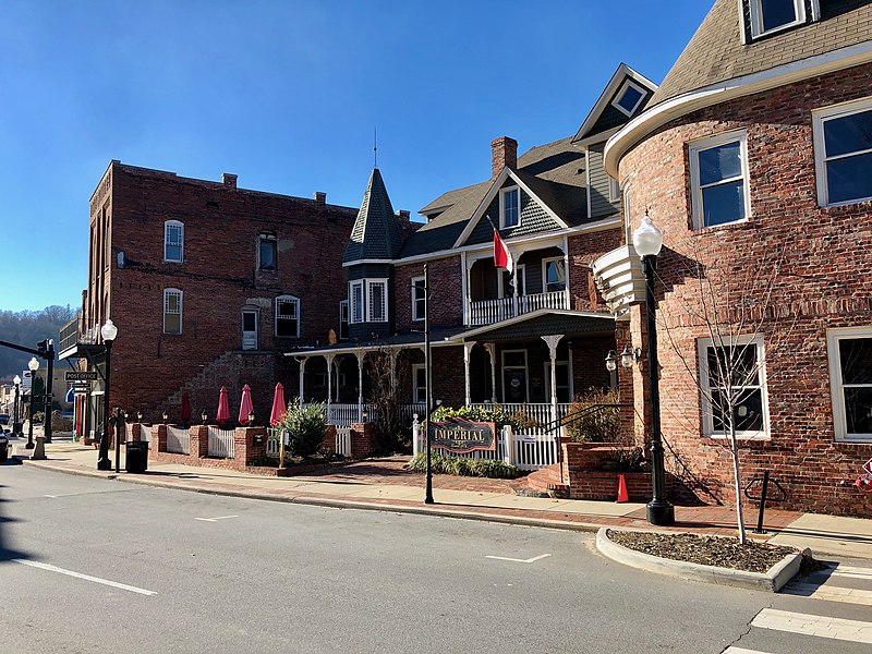
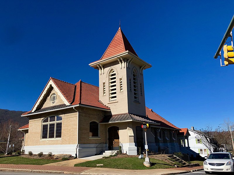
Some of the country's most noteable architects helped create the Haywood County places including Henry Gaines and Benton & Benton. Prominent architectural styles found in Haywood Country are Early Commercial, Bungalow/Craftsman and Classical Revival.

Canton Main Street Historic District (added 2005 - - #05000958)
Bounded roughly by Park St., Main St., Bridge St., and Adams St. , Canton
Ser Amantio di Nicolao, CC0, via Wikimedia Commons
Historic Significance:
Event, Architecture/Engineering
Architect, builder, or engineer:
et.al., Benton & Benton
Architectural Style:
Early Commercial, Late 19th And 20th Century Revivals
Area of Significance:
Architecture, Commerce
Period of Significance:
1950-1974, 1925-1949, 1900-1924, 1875-1899
Owner:
Local, Private
Historic Function:
Commerce/Trade, Domestic, Government, Recreation And Culture
Historic Sub-function:
Department Store, Financial Institution, Hotel, Post Office, Professional, Specialty Store, Theater
Current Function:
Commerce/Trade, Recreation And Culture, Religion
Current Sub-function:
Financial Institution, Professional, Religious Structure, Restaurant, Specialty Store, Theater
Frog Level Historic District (added 2003 - - #03000854)
Roughly bounded by Commerce and Boundary Sts., Water St. and Richland Creek, Depot St., and 80 Commerce St. , Waynesville
Ser Amantio di Nicolao, CC0, via Wikimedia Commons
Historic Significance:
Architecture/Engineering, Event
Architectural Style:
Romanesque, Early Commercial
Area of Significance:
Architecture, Commerce
Period of Significance:
1925-1949, 1900-1924
Owner:
Local, Private
Historic Function:
Commerce/Trade, Defense, Social
Historic Sub-function:
Arms Storage, Meeting Hall, Restaurant, Specialty Store, Warehouse
Current Function:
Commerce/Trade, Social, Vacant/Not In Use
Current Sub-function:
Meeting Hall, Specialty Store, Warehouse
Spread Out Historic District (added 2010 - - #10001095)
Roughly bounded by N Main St, Walnut St, and Beech St, Waynesville
Ser Amantio di Nicolao, CC0, via Wikimedia Commons
Historic Significance:
Architecture/Engineering
Architectural Style:
Colonial Revival, Bungalow/Craftsman
Area of Significance:
Architecture
Period of Significance:
1950-1974, 1925-1949, 1900-1924, 1875-1899
Waynesville Main Street Historic District (added 2005 - - #05001414)
Roughly bounded by Depot St., Church and E. Sts, Wall St., and Montgomery St. , Waynesville
Ser Amantio di Nicolao, CC0, via Wikimedia Commons
Historic Significance:
Event, Architecture/Engineering
Architect, builder, or engineer:
et.al., Gaines, Henry
Architectural Style:
Early Commercial, Classical Revival
Area of Significance:
Architecture, Commerce
Period of Significance:
1950-1974, 1925-1949, 1900-1924, 1875-1899
Owner:
Local, Private
Historic Function:
Commerce/Trade, Government, Social
Historic Sub-function:
Courthouse, Department Store, Financial Institution, Meeting Hall, Post Office, Professional, Specialty Store
Current Function:
Commerce/Trade, Government
Current Sub-function:
Business, Courthouse, Financial Institution, Government Office, Professional, Restaurant, Specialty Store
Return to Top
Select a Different North Carolina County (map)
Alamance
Anson
Ashe
Avery
Beaufort
Bertie
Bladen
Brunswick
Buncombe
Burke
Cabarrus
Caldwell
Camden
Carteret
Caswell
Catawba
Chatham
Cherokee
Chowan
Clay
Cleveland
Craven
Cumberland
Currituck
Dare
Davidson
Davie
Duplin
Durham
Edgecombe
Forsyth
Franklin
Gaston
Gates
Graham
Granville
Greene
Guilford
Halifax
Harnett
Haywood
Henderson
Hertford
Hoke
Hyde
Iredell
Jackson
Johnston
Jones
Lee
Lenoir
Lincoln
Macon
Madison
Martin
McDowell
Mecklenburg
Mitchell
Montgomery
Moore
Nash
New Hanover
Northampton
Onslow
Orange
Pasquotank
Pender
Perquimans
Person
Pitt
Polk
Randolph
Richmond
Robeson
Rockingham
Rowan
Rutherford
Sampson
Scotland
Stanly
Stokes
Surry
Swain
Transylvania
Tyrrell
Union
Vance
Wake
Warren
Washington
Watauga
Wayne
Wilkes
Wilson
Yancey
Select a Different State (map)
Alabama
Alaska
Arizona
Arkansas
California
Colorado
Connecticut
Delaware
District Of Columbia
Florida
Georgia
Hawaii
Idaho
Illinois
Indiana
Iowa
Kansas
Kentucky
Louisiana
Maine
Maryland
Massachusetts
Michigan
Minnesota
Mississippi
Missouri
Montana
Nebraska
Nevada
New Hampshire
New Jersey
New Mexico
New York
North Carolina
North Dakota
Ohio
Oklahoma
Oregon
Pennsylvania
Rhode Island
South Carolina
South Dakota
Tennessee
Texas
Utah
Vermont
Virginia
Washington
West Virginia
Wisconsin
Wyoming
Return to Home Page