South Carolina - Charleston County
Charleston County South Carolina has 50 places on the National Register of Historic Places including 27 places of National significance and 7 places of Statewide significance. Significant places include Aiken, William, House and Associated Railroad Structures, Ashley Hall Plantation, Ashley River Road, Auld Mound and Bache, Alexander, U.S. Coast Survey Line.

Prehistoric cultural affiliation(s) include Native American, Formative Period and Middle Woodland dating back to 2499 BC.

Many famous people are associated with these Charleston County historic places including Stephen Bull, William Aiken Sr., Charles Pinckney, John Townsend, Barnwell,Edward,III and Gov. Thomas Bennett.

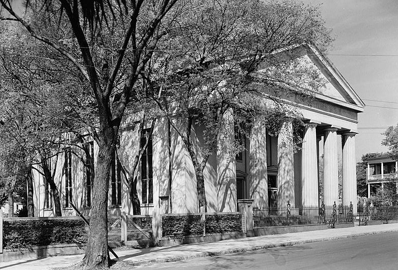
Some of the country's most noteable architects helped create the Charleston County places including E.B. White, Edward Brickell White, Robert Mills, Capt. G. P. Howell, C.M. Trott, William Harmon Beers, Winslow Lewis, Mr. Curtis, W. L. Stoddart and John P. Hutchinson. Prominent architectural styles found in Charleston Country are Greek Revival, Late Victorian and Federal.

Aiken, Gov. William, House (added 1977 - - #77001216)
Also known as Robinson-Aiken House
48 Elizabeth St. , Charleston
ProfReader, CC BY-SA 3.0, via Wikimedia Commons
Historic Significance:
Person, Information Potential, Architecture/Engineering
Architect, builder, or engineer:
Unknown
Architectural Style:
Federal, Greek Revival, Late Victorian
Historic Person:
Aiken,William,Sr.,et al.
Significant Year:
1833, 1857, 1820
Area of Significance:
Politics/Government, Historic - Non-Aboriginal, Architecture
Cultural Affiliation:
American,Urban
Period of Significance:
1900-1924, 1875-1899, 1850-1874, 1825-1849, 1800-1824
Owner:
Private
Historic Function:
Domestic
Historic Sub-function:
Secondary Structure, Single Dwelling
Current Function:
Work In Progress
More Information:
Aiken, William, House and Associated Railroad Structures (added 1966 - - #66000698)
456 King St. , Charleston
ProfReader, CC BY-SA 3.0, via Wikimedia Commons
Historic Significance:
Event
Area of Significance:
Transportation
Period of Significance:
1850-1874, 1825-1849, 1800-1824
Owner:
Private
Historic Function:
Commerce/Trade, Domestic, Transportation
Historic Sub-function:
Rail-Related, Secondary Structure, Single Dwelling, Warehouse
Current Function:
Commerce/Trade, Recreation And Culture, Transportation
Current Sub-function:
Museum, Professional, Rail-Related
More Information:
Ashley Hall Plantation (added 1975 - - #75001691)
Address Restricted , Charleston
ProfReader, Public domain, via Wikimedia Commons
Historic Significance:
Information Potential, Person, Architecture/Engineering
Architect, builder, or engineer:
Unknown
Architectural Style:
No Style Listed
Historic Person:
Bull,Stephen,et al.
Significant Year:
1670, 1704, 1865
Area of Significance:
Politics/Government, Engineering, Architecture, Prehistoric, Landscape Architecture, Agriculture
Cultural Affiliation:
Native American
Period of Significance:
1850-1874, 1825-1849, 1800-1824, 1750-1799, 1700-1749, 1650-1699
Owner:
Private
Historic Function:
Domestic, Landscape, Recreation And Culture
Historic Sub-function:
Forest, Secondary Structure, Single Dwelling, Village Site, Work Of Art (Sculpture, Carving, Rock Art)
Current Function:
Domestic, Recreation And Culture
Current Sub-function:
Single Dwelling, Work Of Art (Sculpture, Carving, Rock Art)
Ashley River Historic District (added 1994 - - #93001514)
Also known as See Also:72001198;66000701;69000165;71000755;83003831
Roughly, along the Ashley R. from just E of SC 165 to the Seaboard Coast Line RR bridge , Charleston
Goingstuckey, CC0, via Wikimedia Commons
Historic Significance:
Architecture/Engineering, Event
Architectural Style:
Georgian, Italianate, Other
Area of Significance:
Transportation, Agriculture, Architecture
Period of Significance:
1925-1949, 1900-1924, 1875-1899, 1850-1874, 1825-1849, 1800-1824, 1750-1799, 1700-1749, 1650-1699
Owner:
State, Private
Historic Function:
Defense, Domestic, Landscape, Transportation
Historic Sub-function:
Fortification, Garden, Natural Feature, Road-Related, Single Dwelling, Village Site
Current Function:
Domestic, Landscape, Recreation And Culture, Transportation
Current Sub-function:
Museum, Natural Feature, Outdoor Recreation, Rail-Related, Road-Related, Single Dwelling
More Information:
Ashley River Road (added 1983 - - #83003831)
SC 61 between Church Creek and SC 165 , Summerville
Ammodramus, CC0, via Wikimedia Commons
Historic Significance:
Event
Area of Significance:
Exploration/Settlement, Transportation
Period of Significance:
1650-1699
Owner:
State
Historic Function:
Transportation
Historic Sub-function:
Road-Related
Current Function:
Transportation
Current Sub-function:
Road-Related
More Information:
Atlanticville Historic District (added 2007 - - #07000927)
Middle St., Jasper Blvd., Myrtle Ave. bet. Stations 22-1/2 and 26 , Sullivan's Island
send us a photo to share
Historic Significance:
Event, Architecture/Engineering
Architectural Style:
No Style Listed
Area of Significance:
Community Planning And Development, Architecture
Period of Significance:
1950-1974, 1925-1949, 1900-1924, 1875-1899
Owner:
State, Private
Historic Function:
Domestic, Religion
Historic Sub-function:
Multiple Dwelling, Religious Structure, Single Dwelling
Current Function:
Domestic, Religion
Current Sub-function:
Multiple Dwelling, Religious Structure, Single Dwelling
More Information:
Auld Mound (added 1970 - - #70000583)
Also known as 38CH41;Yough Hall Plantation Shell Ring
Address Restricted , Mount Pleasant
send us a photo to share
Historic Significance:
Information Potential
Area of Significance:
Prehistoric
Cultural Affiliation:
Native American
Period of Significance:
2000-2499 BC
Owner:
Private
Historic Function:
Unknown
Current Function:
Landscape
Current Sub-function:
Unoccupied Land
Bache, Alexander, U.S. Coast Survey Line (added 2007 - - #07001082)
8377 State Cabin Rd. , Edisto Island
Ammodramus, CC0, via Wikimedia Commons
Historic Significance:
Event
Area of Significance:
Commerce, Maritime History, Transportation
Period of Significance:
1850-1874
Owner:
Private, State
Historic Function:
Commerce/Trade, Transportation
Historic Sub-function:
Business, Water-Related
Current Function:
Recreation And Culture
Current Sub-function:
Monument/Marker
More Information:
Bailey's Store (added 1986 - - #86003204)
On Store Creek at jct. of SC 174 and Point of Pines Rd. , Edisto Island
Ammodramus, CC0, via Wikimedia Commons
Historic Significance:
Event, Architecture/Engineering
Architect, builder, or engineer:
Unknown
Architectural Style:
No Style Listed
Area of Significance:
Architecture, Commerce
Period of Significance:
1900-1924, 1825-1849
Owner:
Private
Historic Function:
Commerce/Trade
Historic Sub-function:
Department Store
Current Function:
Commerce/Trade
Current Sub-function:
Business
More Information:
Barnwell House (added 1980 - - #80003657)
Also known as Prospect Hill Plantation
S of Charleston , Charleston
send us a photo to share
Historic Significance:
Architecture/Engineering, Person
Architect, builder, or engineer:
Unknown
Architectural Style:
No Style Listed
Historic Person:
Barnwell,Edward,III
Significant Year:
1878
Area of Significance:
Architecture, Social History
Period of Significance:
1875-1899
Owner:
Private
Historic Function:
Domestic
Historic Sub-function:
Secondary Structure, Single Dwelling
Current Function:
Work In Progress
More Information:
Bass Pond Site (added 1979 - - #79002379)
Also known as 38CH124
Address Restricted , Kiawah Island
send us a photo to share
Historic Significance:
Information Potential
Area of Significance:
Prehistoric
Cultural Affiliation:
Formative Period, Middle Woodland
Period of Significance:
499-0 BC, 2000-2499 BC
Owner:
Private
Historic Function:
Domestic
Historic Sub-function:
Camp, Village Site
Current Function:
Landscape
Current Sub-function:
Unoccupied Land
Battery Cheves (added 1982 - - #82003841)
James Island , Fort Johnson Estates
Antony-22, CC BY-SA 4.0, via Wikimedia Commons
Historic Significance:
Architecture/Engineering, Event
Architect, builder, or engineer:
Unknown
Architectural Style:
No Style Listed
Area of Significance:
Military, Engineering
Period of Significance:
1850-1874
Owner:
Private
Historic Function:
Defense
Historic Sub-function:
Fortification
Current Function:
Landscape
Current Sub-function:
Underwater
More Information:
Battery Gadsden (added 1974 - - #74001842)
2017 Ion Ave. , Sullivan's Island
BrineStans, CC BY-SA 3.0, via Wikimedia Commons
Historic Significance:
Architecture/Engineering, Event
Architect, builder, or engineer:
Howell,Capt. G. P.
Architectural Style:
No Style Listed
Area of Significance:
Military, Engineering
Period of Significance:
1900-1924
Owner:
Local
Historic Function:
Defense
Historic Sub-function:
Fortification
Current Function:
Vacant/Not In Use
More Information:
Battery LeRoy (added 1982 - - #82004786)
Riverland Dr. , James Island
send us a photo to share
Historic Significance:
Event, Architecture/Engineering
Architect, builder, or engineer:
Unknown
Architectural Style:
No Style Listed
Area of Significance:
Military, Engineering
Period of Significance:
1850-1874
Owner:
Private
Historic Function:
Defense
Historic Sub-function:
Fortification
Current Function:
Landscape
Current Sub-function:
Unoccupied Land
More Information:
Battery No. 1 (added 1982 - - #82004787)
Riverland Dr. , James Island
send us a photo to share
Historic Significance:
Event, Architecture/Engineering
Architect, builder, or engineer:
Unknown
Architectural Style:
No Style Listed
Area of Significance:
Military, Engineering
Period of Significance:
1850-1874
Owner:
Private
Historic Function:
Defense
Historic Sub-function:
Fortification
Current Function:
Landscape
Current Sub-function:
Underwater
More Information:
Battery No. 5 (added 1982 - - #82004788)
Stonefield Subdivision , James Island
send us a photo to share
Historic Significance:
Event, Architecture/Engineering
Architect, builder, or engineer:
Unknown
Architectural Style:
No Style Listed
Area of Significance:
Military, Engineering
Period of Significance:
1850-1874
Owner:
Private
Historic Function:
Defense
Historic Sub-function:
Fortification
Current Function:
Landscape
Current Sub-function:
Underwater
More Information:
Battery Thomson (added 1974 - - #74001843)
2013 Ion Ave. , Sullivan's Island
BrineStans, CC BY-SA 3.0, via Wikimedia Commons
Historic Significance:
Architecture/Engineering, Event
Architect, builder, or engineer:
Howell,Capt. G. P.
Architectural Style:
No Style Listed
Area of Significance:
Engineering, Military
Period of Significance:
1900-1924
Owner:
Local
Historic Function:
Defense
Historic Sub-function:
Fortification
Current Function:
Recreation And Culture
Current Sub-function:
Outdoor Recreation
More Information:
Battery Tynes (added 1982 - - #82004789)
Stono River , James Island
send us a photo to share
Historic Significance:
Event, Architecture/Engineering
Architect, builder, or engineer:
Unknown
Architectural Style:
No Style Listed
Area of Significance:
Military, Engineering
Period of Significance:
1850-1874
Owner:
Private
Historic Function:
Defense
Historic Sub-function:
Fortification
Current Function:
Landscape
Current Sub-function:
Unoccupied Land
More Information:
Battery Wilkes (added 1982 - - #82001516)
St Andrew's Parish , Longbranch Estates
send us a photo to share
Historic Significance:
Event
Area of Significance:
Military
Period of Significance:
1850-1874
Owner:
Private
Historic Function:
Defense
Historic Sub-function:
Fortification
Current Function:
Landscape
More Information:
Bennett, Gov. Thomas, House (added 1978 - - #78002496)
69 Barre St. , Charleston
ProfReader, CC BY-SA 3.0, via Wikimedia Commons
Historic Significance:
Architecture/Engineering, Person
Architect, builder, or engineer:
Unknown
Architectural Style:
No Style Listed
Historic Person:
Bennett,Gov. Thomas
Significant Year:
1825
Area of Significance:
Politics/Government, Industry, Architecture, Commerce
Period of Significance:
1825-1849
Owner:
Private
Historic Function:
Domestic
Historic Sub-function:
Single Dwelling
Current Function:
Domestic
Current Sub-function:
Institutional Housing
More Information:
Bethel African Methodist Episcopal Church (added 2004 - - #04000651)
Also known as Old Bethel African Methodist Episcopal Church
369 Drayton St. , McClellanville
Ammodramus, CC0, via Wikimedia Commons
Historic Significance:
Architecture/Engineering, Event
Architectural Style:
Gothic
Area of Significance:
Black, Architecture
Period of Significance:
1950-1974, 1925-1949, 1900-1924, 1875-1899, 1850-1874
Owner:
Private
Historic Function:
Funerary, Religion
Historic Sub-function:
Cemetery, Religious Structure
Current Function:
Social, Work In Progress
Current Sub-function:
Meeting Hall
More Information:
Bethel Methodist Church (added 1974 - - #74002260)
57 Pitt St. , Charleston
KudzuVine, Public domain, via Wikimedia Commons
Historic Significance:
Architecture/Engineering
Architect, builder, or engineer:
Curtis,Mr.
Architectural Style:
Greek Revival
Area of Significance:
Architecture
Period of Significance:
1850-1874
Owner:
Private
Historic Function:
Religion
Historic Sub-function:
Religious Structure
Current Function:
Religion
Current Sub-function:
Religious Structure
More Information:
Blacklock, William, House (added 1973 - - #73001681)
18 Bull St. , Charleston
KudzuVine, Public domain, via Wikimedia Commons
Historic Significance:
Architecture/Engineering
Architect, builder, or engineer:
Unknown
Architectural Style:
Federal, Other
Area of Significance:
Architecture
Period of Significance:
1800-1824
Owner:
Private
Historic Function:
Domestic
Historic Sub-function:
Single Dwelling
Current Function:
Education
Current Sub-function:
College
More Information:
Blake Tenements (added 1970 - - #70000572)
2--4 Courthouse Sq. , Charleston
ProfReader, CC BY-SA 3.0, via Wikimedia Commons
Historic Significance:
Architecture/Engineering
Architect, builder, or engineer:
Unknown
Architectural Style:
No Style Listed
Area of Significance:
Architecture
Period of Significance:
1750-1799
Owner:
Local
Historic Function:
Domestic
Historic Sub-function:
Multiple Dwelling
Current Function:
Vacant/Not In Use
More Information:
Bleak Hall Plantation Outbuildings (added 1973 - - #73001698)
4 mi. SE of Edisto Island off SC 174 , Edisto Island
Generic1139, Public domain, via Wikimedia Commons
Historic Significance:
Architecture/Engineering, Event, Person
Architect, builder, or engineer:
Unknown
Architectural Style:
Gothic Revival
Historic Person:
Townsend,John
Significant Year:
1840
Area of Significance:
Politics/Government, Agriculture, Architecture
Period of Significance:
1825-1849
Owner:
Private
Historic Function:
Domestic
Historic Sub-function:
Secondary Structure
Current Function:
Domestic
Current Sub-function:
Secondary Structure
More Information:
Boone Hall Plantation House and Historic Landscape (Boundary Increase) (added 1994 - - #93001512)
Also known as See Also:Slave Street, Smokehouse, and Allee, Boone Hall Pla
Long Point Rd. W of jct. with US 17/701 , Mount Pleasant
KudzuVine, Public domain, via Wikimedia Commons
Historic Significance:
Architecture/Engineering, Event
Architect, builder, or engineer:
Beers, William Harmon, Trott, C.M.
Architectural Style:
Colonial Revival
Area of Significance:
Entertainment/Recreation, Architecture, Agriculture
Period of Significance:
1925-1949, 1900-1924, 1875-1899, 1850-1874
Owner:
Private
Historic Function:
Agriculture/Subsistence, Domestic, Landscape
Historic Sub-function:
Agricultural Fields, Agricultural Outbuildings, Garden, Secondary Structure, Single Dwelling
Current Function:
Agriculture/Subsistence, Commerce/Trade, Domestic, Landscape, Recreation And Culture
Current Sub-function:
Garden, Museum, Restaurant, Single Dwelling, Specialty Store
More Information:
Branford-Horry House (added 1970 - - #70000573)
59 Meeting St. , Charleston
ProfReader, CC BY-SA 3.0, via Wikimedia Commons
Historic Significance:
Architecture/Engineering
Architect, builder, or engineer:
Unknown
Architectural Style:
Georgian
Area of Significance:
Architecture
Period of Significance:
1825-1849, 1750-1799
Owner:
Private
Historic Function:
Domestic
Historic Sub-function:
Single Dwelling
Current Function:
Domestic
Current Sub-function:
Single Dwelling
More Information:
Brewton, Miles, House (added 1966 - - #66000699)
27 King St. , Charleston
ProfReader, CC BY-SA 3.0, via Wikimedia Commons
Historic Significance:
Architecture/Engineering
Architect, builder, or engineer:
Unknown
Architectural Style:
Other, Georgian
Area of Significance:
Architecture
Period of Significance:
1750-1799
Owner:
Private
Historic Function:
Domestic, Landscape
Historic Sub-function:
Forest, Single Dwelling
Current Function:
Domestic, Landscape
Current Sub-function:
Forest, Single Dwelling
More Information:
Brewton, Robert, House (added 1966 - - #66000700)
71 Church St. , Charleston
Finavon, Public domain, via Wikimedia Commons
Historic Significance:
Architecture/Engineering
Architect, builder, or engineer:
Unknown
Architectural Style:
Other
Area of Significance:
Architecture
Period of Significance:
1700-1749
Owner:
Private
Historic Function:
Domestic
Historic Sub-function:
Secondary Structure, Single Dwelling
Current Function:
Domestic
Current Sub-function:
Secondary Structure, Single Dwelling
More Information:
Brick House Ruin (added 1970 - - #70000580)
Also known as Brick House Ruins,Edisto Island
S of Edisto Island , Edisto Island
KudzuVine, Public domain, via Wikimedia Commons
Historic Significance:
Architecture/Engineering
Architect, builder, or engineer:
Unknown
Architectural Style:
Other, Colonial
Area of Significance:
Architecture
Period of Significance:
1700-1749
Owner:
Private
Historic Function:
Domestic
Historic Sub-function:
Single Dwelling
Current Function:
Vacant/Not In Use
More Information:
Brooklands Plantation (added 1987 - - #86003198)
Off Laurel Hill Rd. on Scanawah Island , Edisto Island
KudzuVine, Public domain, via Wikimedia Commons
Historic Significance:
Event, Architecture/Engineering
Architect, builder, or engineer:
Unknown
Architectural Style:
Greek Revival
Area of Significance:
Architecture, Agriculture
Period of Significance:
1800-1824
Owner:
Private
Historic Function:
Domestic, Funerary
Historic Sub-function:
Cemetery, Single Dwelling
Current Function:
Unknown
More Information:
Buzzard's Island Site (added 1970 - - #70000584)
Address Restricted , Mount Pleasant
send us a photo to share
Historic Significance:
Information Potential
Area of Significance:
Prehistoric
Cultural Affiliation:
Native American
Period of Significance:
2000-2499 BC
Owner:
Private
Historic Function:
Unknown
Current Function:
Landscape
Current Sub-function:
Underwater
Cape Romain Lighthouses (added 1981 - - #81000563)
SE of McClellanville on Lighthouse Island , McClellanville
KudzuVine, Public domain, via Wikimedia Commons
Historic Significance:
Architecture/Engineering, Event
Architect, builder, or engineer:
Lewis,Winslow
Architectural Style:
No Style Listed
Area of Significance:
Transportation, Engineering
Period of Significance:
1850-1874, 1825-1849
Owner:
Federal
Historic Function:
Transportation
Historic Sub-function:
Water-Related
Current Function:
Vacant/Not In Use
More Information:
Cassina Point (added 1986 - - #86003210)
Also known as Hopkinson House
Cassina Point Rd. , Edisto Island
KudzuVine, Public domain, via Wikimedia Commons
Historic Significance:
Event, Architecture/Engineering
Architect, builder, or engineer:
Unknown
Architectural Style:
No Style Listed
Area of Significance:
Agriculture, Architecture
Period of Significance:
1850-1874, 1825-1849
Owner:
Private
Historic Function:
Domestic
Historic Sub-function:
Single Dwelling
Current Function:
Domestic
Current Sub-function:
Single Dwelling
More Information:
Castle Pinckney (added 1970 - - #70000574)
Shute's Folly Island , Charleston
Erwin Lindemann, Public domain, via Wikimedia Commons
Historic Significance:
Information Potential, Event, Architecture/Engineering
Architect, builder, or engineer:
Unknown
Architectural Style:
Other
Area of Significance:
Historic - Non-Aboriginal, Military, Engineering
Cultural Affiliation:
American
Period of Significance:
1800-1824
Owner:
Private
Historic Function:
Defense
Historic Sub-function:
Fortification
Current Function:
Work In Progress
More Information:
Central Baptist Church (added 1977 - - #77001217)
26 Radcliffe St. , Charleston
Ammodramus, CC0, via Wikimedia Commons
Historic Significance:
Architecture/Engineering, Event
Architect, builder, or engineer:
Hutchinson,John P.
Architectural Style:
Other, Gothic
Area of Significance:
Art, Black, Religion, Architecture
Period of Significance:
1900-1924, 1875-1899
Owner:
Private
Historic Function:
Religion
Historic Sub-function:
Church School, Religious Structure
Current Function:
Religion
Current Sub-function:
Church School, Religious Structure
More Information:
Charleston Cemeteries Historic District (added 2017 - - #100001367)
Huguenin Avenue, roughly bounded by Algonquin Road, CSX railroad, North Romney and Meeting Streets, Charleston
ProfReader, CC BY-SA 4.0, via Wikimedia Commons
Historic Significance:
Event, Architecture/Engineering
Architectural Style:
Gothic, Mixed (More Than 2 Styles From Different Periods)
Area of Significance:
Social History, Landscape Architecture, Art
Period of Significance:
1850-1956 AD
Charleston Consolidated Railway, Electric and Gas Company Car House (added 2017 - - #100000686)
649 Meeting Street, Charleston
Cmalaspina, CC BY-SA 4.0, via Wikimedia Commons
Historic Significance:
Event
Area of Significance:
Transportation
Period of Significance:
1897-1938 AD
Charleston Historic District (added 1978 - - #78002497)
Also known as Charleston Historic District Boundary Increase II;See Also:6
Incorporates most of area S of Bee, Morris, and Mary Sts. to Waterfront , Charleston
send us a photo to share
Historic Significance:
Architecture/Engineering, Event
Architect, builder, or engineer:
White,Edward Brickell, Et al.
Architectural Style:
Other, Greek Revival, Late Victorian
Area of Significance:
Art, Literature, Education, Politics/Government, Landscape Architecture, Religion, Architecture
Period of Significance:
1900-1924, 1875-1899, 1850-1874, 1825-1849, 1800-1824, 1750-1799, 1700-1749
Owner:
Local, Private
Historic Function:
Commerce/Trade, Domestic, Education, Religion
Historic Sub-function:
Single Dwelling
Current Function:
Commerce/Trade, Domestic
Current Sub-function:
Single Dwelling
More Information:
Charleston Historic District (added 1966 - - #66000964)
Also known as Old and Historic Charleston;See Also:78002497;84002028;85001
An area roughly bounded by Broad, Bay, S. Battery and Ashley and an area along Church bounded by Cumberland and Chalmers, Charleston
KudzuVine, Public domain, via Wikimedia Commons
Historic Significance:
Architecture/Engineering
Architect, builder, or engineer:
Mills,Robert
Architectural Style:
Other, Greek Revival, Federal
Area of Significance:
Architecture
Period of Significance:
1850-1874, 1825-1849, 1800-1824, 1750-1799, 1700-1749
Owner:
Local, Private
Historic Function:
Commerce/Trade, Domestic, Education, Government
Historic Sub-function:
Single Dwelling
Current Function:
Commerce/Trade, Domestic, Education, Government
Current Sub-function:
Single Dwelling
More Information:
Charleston Historic District (Boundary Increase) (added 1970 - - #70000923)
Also known as Charleston Historic District Boundary Increase I;Old and His
An area roughly bounded by Calhoun, Archdale, Cumberland, E.Battery, Broad and Gadsden and an area along Anson St. , Charleston
send us a photo to share
Historic Significance:
Information Potential, Architecture/Engineering, Event
Architect, builder, or engineer:
White,E.B., Et al.
Architectural Style:
Other, Greek Revival, Late Victorian
Area of Significance:
Art, Historic - Non-Aboriginal, Education, Literature, Politics/Government, Landscape Architecture, Religion, Architecture
Cultural Affiliation:
American
Period of Significance:
1875-1899, 1850-1874, 1825-1849, 1800-1824, 1750-1799, 1700-1749
Owner:
Local, Private
Historic Function:
Commerce/Trade, Domestic, Education, Government, Religion
Historic Sub-function:
Single Dwelling
Current Function:
Commerce/Trade, Domestic, Education, Government, Religion
Current Sub-function:
Single Dwelling
More Information:
Charleston Historic District (Boundary Increase) (added 1984 - - #84002028)
Also known as Charleston Historic District Boundary Increase III;See Also:
King and Calhoun Sts. , Charleston
send us a photo to share
Historic Significance:
Architecture/Engineering
Architect, builder, or engineer:
Stoddart,W. L.
Architectural Style:
Beaux Arts
Area of Significance:
Architecture
Period of Significance:
1900-1924
Owner:
Private
Historic Function:
Domestic
Historic Sub-function:
Hotel
Current Function:
Domestic
Current Sub-function:
Hotel
More Information:
Charleston Naval Hospital Historic District (added 2010 - - #10000851)
Former Charleston Naval Hospital Historic District, North Charleston
ProfReader, CC BY-SA 4.0, via Wikimedia Commons
Historic Significance:
Event, Architecture/Engineering
Architectural Style:
Mission/Spanish Revival, Colonial Revival
Area of Significance:
Architecture, Health/Medicine, Military
Period of Significance:
1925-1949, 1900-1924
Charleston Navy Yard Historic District (added 2006 - - #06000699)
Also known as Charleston Naval Shipyard;Charleston Navy Base, Naval Base Charleston
Roughly bounded by First St., Hobson Ave., Avenue D, Fourth and Fifth Sts., and the drydocks bet. First and Thirteenth S, North Charleston
ProfReader, CC BY-SA 4.0, via Wikimedia Commons
Historic Significance:
Architecture/Engineering, Event
Architect, builder, or engineer:
multiple
Architectural Style:
Modern Movement, Late 19th And 20th Century Revivals
Area of Significance:
Military, Architecture
Period of Significance:
1925-1949, 1900-1924
Owner:
Private, State, Local, Federal
Historic Function:
Defense
Historic Sub-function:
Naval Facility
Current Function:
Commerce/Trade, Education, Industry/Processing/Extraction, Transportation, Vacant/Not In Use
Current Sub-function:
Business, College, Energy Facility, Manufacturing Facility, Warehouse, Water-Related
More Information:
Charleston Navy Yard Officers' Quarters Historic District (added 2007 - - #07000100)
Turnbull Ave., Everglades Dr., Navy Way, and portions of Hobson Ave. and Blackstop Dr. , North Charleston
ProfReader, CC BY-SA 4.0, via Wikimedia Commons
Historic Significance:
Architecture/Engineering, Event
Architectural Style:
Late 19th And 20th Century Revivals, Prairie School
Area of Significance:
Community Planning And Development, Landscape Architecture, Architecture, Military, Social History
Period of Significance:
1925-1949, 1900-1924, 1875-1899
Owner:
Private
Historic Function:
Defense, Domestic, Landscape, Recreation And Culture, Transportation
Historic Sub-function:
Garden, Institutional Housing, Naval Facility, Park, Road-Related, Secondary Structure, Sport Facility
Current Function:
Domestic, Landscape, Recreation And Culture, Transportation, Vacant/Not In Use
Current Sub-function:
Garden, Multiple Dwelling, Park, Pedestrian Related, Road-Related, Single Dwelling, Sport Facility
More Information:
Charleston Old and Historic District (Boundary Increase) (added 1985 - - #85001833)
Also known as Charleston Historic District Boundary Increase IV;See Also:6
25 and 25 1/2 Warren and 114 St. Phillip Sts. , Charleston
send us a photo to share
Historic Significance:
Architecture/Engineering
Architect, builder, or engineer:
Unknown
Architectural Style:
No Style Listed
Area of Significance:
Architecture
Period of Significance:
1900-1924, 1875-1899
Owner:
Private
Historic Function:
Commerce/Trade, Domestic
Historic Sub-function:
Multiple Dwelling
Current Function:
Unknown
More Information:
Charleston Old and Historic District (Boundary Increase) (added 1986 - - #86000588)
Also known as Charleston Historic District Boundary Increase V;Bainbridge
280 E. Bay St. , Charleston
send us a photo to share
Historic Significance:
Architecture/Engineering
Architect, builder, or engineer:
Unknown
Architectural Style:
No Style Listed
Area of Significance:
Architecture
Period of Significance:
1900-1924
Owner:
Private
Historic Function:
Commerce/Trade, Industry/Processing/Extraction
Historic Sub-function:
Manufacturing Facility, Warehouse
Current Function:
Unknown
More Information:
Charleston Old and Historic District (Boundary Increase) (added 1989 - - #89000603)
Also known as See Also:66000964;70000923;78002497;84002028;85001833;860005
Roughly bounded by US 17, E. Bay, Charlotte, Cooper River, Laurens, Alexander, Calhoun, Coming, Morris, Bee, & Courtnay , Charleston
send us a photo to share
Historic Significance:
Event, Architecture/Engineering
Architect, builder, or engineer:
Multiple
Architectural Style:
Mid 19th Century Revival, Classical Revival, Late Victorian
Area of Significance:
Commerce, Transportation, Education, Architecture, Community Planning And Development, Black, Industry
Period of Significance:
1925-1949, 1900-1924, 1900-1750 AD, 1700-1749
Owner:
Local, Private
Historic Function:
Commerce/Trade, Domestic, Education, Government, Industry/Processing/Extraction, Transportation
Historic Sub-function:
Manufacturing Facility, Multiple Dwelling, School, Single Dwelling
Current Function:
Commerce/Trade, Domestic, Education, Government, Industry/Processing/Extraction, Transportation
Current Sub-function:
Manufacturing Facility, Multiple Dwelling, School, Single Dwelling
Charleston's French Quarter District (added 1973 - - #73001682)
Also known as Lodge Alley;Simmons Alley
Bounded by Lodge Alley and Cumberland, E. Bay, and State Sts. , Charleston
Migebert, CC BY-SA 3.0, via Wikimedia Commons
Historic Significance:
Architecture/Engineering, Event
Architect, builder, or engineer:
Unknown
Architectural Style:
No Style Listed
Area of Significance:
Politics/Government, Architecture, Commerce, Social History
Period of Significance:
1825-1849, 1800-1824, 1750-1799, 1700-1749
Owner:
Private
Historic Function:
Commerce/Trade
Historic Sub-function:
Warehouse
Current Function:
Commerce/Trade, Industry/Processing/Extraction, Vacant/Not In Use
More Information:
Christ Church (added 1972 - - #72001201)
4.6 mi. NE of Mount Pleasant on U.S. 17 , Mount Pleasant
Ammodramus, CC0, via Wikimedia Commons
Historic Significance:
Event, Architecture/Engineering, Person
Architect, builder, or engineer:
Unknown
Architectural Style:
Colonial
Historic Person:
Pinckney,Charles,et al.
Significant Year:
1787, 1726
Area of Significance:
Politics/Government, Architecture, Religion
Period of Significance:
1750-1799, 1700-1749
Owner:
Private
Historic Function:
Religion
Historic Sub-function:
Religious Structure
Current Function:
Religion
Current Sub-function:
Religious Structure
More Information:

Page 1 > 2 > 3 > 4

Return to Top
Select a Different South Carolina County (map)
Abbeville
Aiken
Allendale
Anderson
Bamberg
Barnwell
Beaufort
Berkeley
Calhoun
Charleston
Cherokee
Chester
Chesterfield
Clarendon
Colleton
Darlington
Dillon
Dorchester
Edgefield
Fairfield
Florence
Georgetown
Greenville
Greenwood
Hampton
Horry
Jasper
Kershaw
Lancaster
Laurens
Lee
Lexington
Marion
Marlboro
McCormick
Newberry
Oconee
Orangeburg
Pickens
Richland
Saluda
Spartanburg
Sumter
Union
Williamsburg
York
Select a Different State (map)
Alabama
Alaska
Arizona
Arkansas
California
Colorado
Connecticut
Delaware
District Of Columbia
Florida
Georgia
Hawaii
Idaho
Illinois
Indiana
Iowa
Kansas
Kentucky
Louisiana
Maine
Maryland
Massachusetts
Michigan
Minnesota
Mississippi
Missouri
Montana
Nebraska
Nevada
New Hampshire
New Jersey
New Mexico
New York
North Carolina
North Dakota
Ohio
Oklahoma
Oregon
Pennsylvania
Rhode Island
South Carolina
South Dakota
Tennessee
Texas
Utah
Vermont
Virginia
Washington
West Virginia
Wisconsin
Wyoming
Return to Home Page