Pennsylvania - Montgomery County - Historic Districts
Montgomery County Pennsylvania (Historic Districts) has 30 places on the National Register of Historic Places including 5 places of National significance and 6 places of Statewide significance. Significant places include Bryn Athyn Historic District, Compton and Bloomfield, Evansburg Historic District, Plymouth Meeting Historic District and Valley Forge National Historical Park.

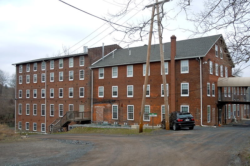
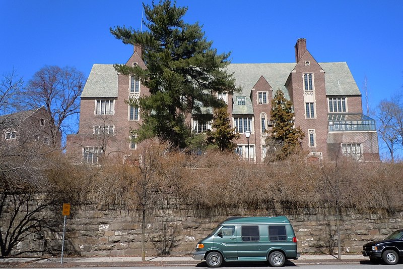
Several famous people are associated with these Montgomery County historic places including George Washington, Louis Ewald, Elsa Ueland and John R. Conner.

Some of the country's most noteable architects helped create the Montgomery County places including Louis Duportail, Wilson Eyre Jr., Pitcairn Price, Carrere,Hastings,Cram,Trout, Theophilus P. Chandler, Cope & Stewardson, Horace Trumbauer, George Burdett Ford, Thomas Oakes and Walter Price. Prominent architectural styles found in Montgomery Country are Queen Anne, Federal and Gothic.

Abington Township High School (added 1985 - - #85001676)
Also known as Huntingdon Junior High School
1801 Susquehanna Rd. , Abington
Smallbones, CC0, via Wikimedia Commons
Historic Significance:
Architecture/Engineering, Event
Architect, builder, or engineer:
Multiple
Architectural Style:
Romanesque, Queen Anne, Art Deco
Area of Significance:
Education, Architecture
Period of Significance:
1925-1949, 1900-1924, 1875-1899
Owner:
Local
Historic Function:
Education
Historic Sub-function:
School
Current Function:
Education
Bergy Bridge Historic District (added 1973 - - #73001644)
Also known as Branchville Bridge
NW of Harleysville off PA 63 , Harleysville
Smallbones, CC0, via Wikimedia Commons
Historic Significance:
Event, Architecture/Engineering
Architect, builder, or engineer:
Unknown
Architectural Style:
No Style Listed
Area of Significance:
Transportation, Architecture, Engineering, Agriculture
Period of Significance:
1850-1874, 1825-1849, 1800-1824
Owner:
Local, Private
Historic Function:
Agriculture/Subsistence, Domestic, Landscape, Transportation
Historic Sub-function:
Agricultural Outbuildings, Forest, Road-Related, Single Dwelling
Current Function:
Agriculture/Subsistence, Domestic, Landscape, Transportation
Current Sub-function:
Forest, Road-Related, Single Dwelling
Bryn Athyn Historic District (added 2008 - - #08001087)
Also known as Pitcairn Residences: Cairnwood, Cairncrest, Glencairn, Bryn Athlyn Cathedral
Huntington Pike and Cathedral Road , Bryn Athyn
Evrik, Public domain, via Wikimedia Commons
Historic Significance:
Event, Architecture/Engineering
Architect, builder, or engineer:
Price,Pitcairn, Carrere,Hastings,Cram,Trout
Architectural Style:
Beaux Arts, Late Gothic Revival
Area of Significance:
Architecture, Art, Transportation
Period of Significance:
1925-1949, 1900-1924, 1875-1899
Owner:
Private
Historic Function:
Domestic, Religion
Historic Sub-function:
Religious Structure, Single Dwelling
Current Function:
Recreation And Culture, Religion, Social
Current Sub-function:
Meeting Hall, Museum, Religious Structure
Bryn Mawr College Historic District (added 1979 - - #79002299)
Morris Ave., Yarrow St. and New Gulph Rd. , Bryn Mawr
Smallbones, Public domain, via Wikimedia Commons
Historic Significance:
Event, Architecture/Engineering
Architect, builder, or engineer:
Multiple
Architectural Style:
Late Gothic Revival, Other, Gothic
Area of Significance:
Education, Architecture, Landscape Architecture, Social History
Period of Significance:
1950-1974, 1900-1924, 1875-1899
Owner:
Private
Historic Function:
Education
Historic Sub-function:
College
Current Function:
Education
Current Sub-function:
College
Camptown Historic District (added 1985 - - #85003434)
Also known as LaMott Historic District
Roughly bounded by Penrose Ave., Graham Ln., Dennis St., and Cheltenham Ave. , LaMott
Shuvaev, CC BY-SA 3.0, via Wikimedia Commons
Historic Significance:
Event
Area of Significance:
Black, Community Planning And Development, Social History
Period of Significance:
1925-1949, 1900-1924, 1875-1899, 1850-1874
Owner:
Private
Historic Function:
Commerce/Trade, Domestic
Historic Sub-function:
Single Dwelling, Specialty Store
Current Function:
Commerce/Trade, Domestic
Current Sub-function:
Single Dwelling, Specialty Store
Carson College for Orphan Girls (added 1991 - - #91000227)
Also known as Carson Valley School
Between W. Mill and Wissahickon Rds., Springfield Township , Flourtown
Shuvaev, CC BY-SA 3.0, via Wikimedia Commons
Historic Significance:
Architecture/Engineering, Person, Event
Architect, builder, or engineer:
Et al., Kelsey,Albert
Architectural Style:
Tudor Revival
Historic Person:
Ueland,Elsa
Significant Year:
1932, 1930, 1917
Area of Significance:
Education, Social History, Architecture
Period of Significance:
1925-1949, 1900-1924
Owner:
Private
Historic Function:
Domestic, Education
Historic Sub-function:
Institutional Housing, School
Current Function:
Domestic, Education
Current Sub-function:
Institutional Housing, School
Central Norristown Historic District (added 1984 - - #84000321)
Roughly bounded by Stoney Creek, Walnut, Lafayette, and Fornace Sts. , Norristown
Smallbones, CC0, via Wikimedia Commons
Historic Significance:
Event, Architecture/Engineering
Architectural Style:
Other, Italianate, Greek Revival
Area of Significance:
Politics/Government, Architecture, Commerce, Industry
Period of Significance:
1900-1924, 1875-1899, 1850-1874, 1825-1849, 1800-1824
Owner:
Local, Private
Historic Function:
Domestic, Government, Industry/Processing/Extraction
Historic Sub-function:
Courthouse, Manufacturing Facility, Single Dwelling
Current Function:
Commerce/Trade, Domestic, Government
Current Sub-function:
Business, Courthouse, Multiple Dwelling, Single Dwelling
Cold Point Historic District (added 1983 - - #83002261)
Also known as 0425732869
I-276, Butler Pike, Militia Hill and Narcissa Rds. , Norristown
Smallbones, CC0, via Wikimedia Commons
Historic Significance:
Architecture/Engineering, Event
Architect, builder, or engineer:
Multiple
Architectural Style:
Greek Revival, Gothic
Area of Significance:
Architecture, Industry, Agriculture
Period of Significance:
1900-1924, 1875-1899, 1850-1874, 1825-1849, 1800-1824, 1750-1799, 1700-1749
Owner:
Private
Historic Function:
Agriculture/Subsistence, Domestic, Industry/Processing/Extraction, Religion
Historic Sub-function:
Agricultural Outbuildings, Manufacturing Facility, Religious Structure, Single Dwelling
Current Function:
Agriculture/Subsistence, Commerce/Trade, Domestic, Religion
Current Sub-function:
Agricultural Outbuildings, Religious Structure, Single Dwelling
Compton and Bloomfield (added 1978 - - #78002445)
Also known as Morris Arboretum
9414 Meadowbrook Ave. , Whitemarsh
TheCatalyst31, CC BY-SA 3.0, via Wikimedia Commons
Historic Significance:
Event, Architecture/Engineering
Architect, builder, or engineer:
Eyre,Wilson,Jr.,et al., Chandler,Theophilus P.
Architectural Style:
Classical Revival, Late Gothic Revival
Area of Significance:
Education, Architecture, Landscape Architecture
Period of Significance:
1900-1924, 1875-1899
Owner:
Private
Historic Function:
Domestic, Landscape
Historic Sub-function:
Educational Related Housing, Single Dwelling
Current Function:
Domestic, Education, Landscape
Current Sub-function:
Park, Research Facility, Single Dwelling
Continental Stove Works (added 1986 - - #86000040)
Also known as Buckwalter Stove Company
First St. above Main , Royersford
Smallbones, CC BY-SA 3.0, via Wikimedia Commons
Historic Significance:
Event
Area of Significance:
Industry
Period of Significance:
1900-1924, 1875-1899
Owner:
Private
Historic Function:
Commerce/Trade, Industry/Processing/Extraction
Historic Sub-function:
Manufacturing Facility, Warehouse
Current Function:
Commerce/Trade
Current Sub-function:
Warehouse
Evansburg Historic District (added 1972 - - #72001139)
Also known as Providence Square;"Hustletown",Skippack Valley;See Also:Skip
On U.S. 422, bounded by Cross Key Rd., Grange Ave., Mill Rd., and Ridge Pike , Evansburg
Smallbones, CC BY-SA 3.0, via Wikimedia Commons
Historic Significance:
Event, Architecture/Engineering
Architect, builder, or engineer:
Multiple
Architectural Style:
No Style Listed
Area of Significance:
Transportation, Education, Agriculture, Architecture, Commerce, Engineering, Military, Industry, Religion
Period of Significance:
1850-1874, 1825-1849, 1800-1824, 1750-1799
Owner:
Local, State, Private
Historic Function:
Agriculture/Subsistence, Domestic
Historic Sub-function:
Agricultural Fields, Agricultural Outbuildings, Single Dwelling
Current Function:
Agriculture/Subsistence, Domestic
Current Sub-function:
Agricultural Fields, Agricultural Outbuildings, Single Dwelling
Fetter's Mill Village Historic District (added 2006 - - #05001212)
Also known as Bryn Athyn Station
Fetter's Mill Rd. and Pennypack Ln. , Byrn Athyn Borough
Shuvaev, CC BY-SA 3.0, via Wikimedia Commons
Historic Significance:
Event, Person
Historic Person:
Ewald, Louis, Conner, John R.
Significant Year:
1740, 1878, 1902
Area of Significance:
Industry, Transportation, Art
Period of Significance:
1950-1974, 1925-1949, 1900-1924, 1875-1899, 1850-1874, 1825-1849, 1800-1824, 1750-1799, 1700-1749
Owner:
Private, Local
Historic Function:
Agriculture/Subsistence, Domestic, Transportation
Historic Sub-function:
Animal Facility, Rail-Related, Single Dwelling
Current Function:
Domestic, Government
Current Sub-function:
Post Office, Single Dwelling
Gladwyne Historic District (added 1980 - - #80003577)
Also known as Merion Square Historic District
PA 23 , Gladwyne
Hshuvaeva, CC BY-SA 3.0, via Wikimedia Commons
Historic Significance:
Event, Architecture/Engineering
Architect, builder, or engineer:
Unknown
Architectural Style:
No Style Listed
Area of Significance:
Exploration/Settlement, Architecture, Commerce
Period of Significance:
1875-1899, 1850-1874, 1825-1849, 1800-1824
Owner:
Local, Private
Historic Function:
Commerce/Trade, Domestic
Historic Sub-function:
Hotel, Single Dwelling, Specialty Store
Current Function:
Commerce/Trade, Domestic
Current Sub-function:
Hotel, Single Dwelling, Specialty Store
Harriton (added 1985 - - #85003472)
1401--1415 Old Guelph Rd. , Villanova
Pmcyclist, Public domain, via Wikimedia Commons
Historic Significance:
Architecture/Engineering
Architect, builder, or engineer:
Price,Walter, Vaux,Walter S.
Architectural Style:
Bungalow/Craftsman, Queen Anne, Federal
Area of Significance:
Architecture
Period of Significance:
1900-1924, 1825-1849
Owner:
Private
Historic Function:
Domestic
Historic Sub-function:
Hotel, Secondary Structure, Single Dwelling
Current Function:
Domestic
Current Sub-function:
Hotel, Secondary Structure, Single Dwelling
High Street Historic District (added 1992 - - #91001756)
Also known as See Also:Grubb Mansion
631--1329 High St. , Pottstown
Smallbones, CC0, via Wikimedia Commons
Historic Significance:
Architecture/Engineering
Architect, builder, or engineer:
Unknown
Architectural Style:
Other, Queen Anne, Late 19th And 20th Century Revivals
Area of Significance:
Architecture
Period of Significance:
1925-1949, 1900-1924, 1875-1899, 1850-1874
Owner:
Federal, Private
Historic Function:
Commerce/Trade, Domestic
Historic Sub-function:
Multiple Dwelling, Single Dwelling, Specialty Store
Current Function:
Commerce/Trade, Domestic
Current Sub-function:
Business, Multiple Dwelling, Professional, Single Dwelling
Mill Creek Historic District (added 1980 - - #80003575)
E of Bryn Mawr , Bryn Mawr
Smallbones, CC BY-SA 3.0, via Wikimedia Commons
Historic Significance:
Information Potential, Event, Architecture/Engineering
Architect, builder, or engineer:
Unknown
Architectural Style:
Other, Georgian
Area of Significance:
Historic - Non-Aboriginal, Architecture, Industry
Cultural Affiliation:
American,Industrial
Period of Significance:
1825-1849, 1800-1824, 1750-1799, 1700-1749
Owner:
Local, Private
Historic Function:
Domestic, Industry/Processing/Extraction
Historic Sub-function:
Manufacturing Facility, Single Dwelling
Current Function:
Domestic
Current Sub-function:
Single Dwelling
Mill Creek Historic District (Boundary Increase) (added 1996 - - #96000965)
Roughly bounded by the Schuylkill River, Mill Cr., Righter's Mill, Rose Glen, and Monk's Rds., Lower Merion Township , Gladwyne
send us a photo to share
Historic Significance:
Event, Architecture/Engineering, Information Potential
Architect, builder, or engineer:
Gilchrist, Edmund B., et al., Durham, Walter K.
Architectural Style:
Federal, Colonial, Tudor Revival
Area of Significance:
Historic - Non-Aboriginal, Architecture, Industry
Cultural Affiliation:
Euro-American, American,Industrial
Period of Significance:
1925-1949, 1900-1924, 1875-1899, 1850-1874, 1825-1849, 1800-1824, 1750-1799
Owner:
Local, Private
Historic Function:
Domestic, Industry/Processing/Extraction
Historic Sub-function:
Manufacturing Facility, Multiple Dwelling, Secondary Structure, Single Dwelling, Village Site
Current Function:
Commerce/Trade, Domestic
Current Sub-function:
Professional, Secondary Structure
Narbrook Park Historic District (added 2003 - - #03001122)
Also known as Narberth Garden
Narbrook Rd. and Windsor Ave. , Narberth
Smallbones, CC0, via Wikimedia Commons
Historic Significance:
Event, Architecture/Engineering
Architect, builder, or engineer:
et.al., Ford,George Burdett
Architectural Style:
Bungalow/Craftsman, Colonial Revival
Area of Significance:
Community Planning And Development, Landscape Architecture, Architecture
Period of Significance:
1925-1949, 1900-1924
Owner:
Private
Historic Function:
Domestic, Landscape
Historic Sub-function:
Park, Single Dwelling
Current Function:
Domestic, Landscape
Current Sub-function:
Park, Single Dwelling
Oak Park Historic District (added 1998 - - #98000897)
Roughly along Oak Park Rd., Park Ave., Oak Blvd., Forest Ave., and Squirrel Ln. , Hatfiels Township
Smallbones, CC0, via Wikimedia Commons
Historic Significance:
Architecture/Engineering
Architect, builder, or engineer:
et.al., Richardson, Harry
Architectural Style:
Other, Late 19th And Early 20th Century American Movements, Late 19th And 20th Century Revivals
Area of Significance:
Architecture
Period of Significance:
1925-1949, 1900-1924
Owner:
Private
Historic Function:
Domestic, Industry/Processing/Extraction, Landscape, Recreation And Culture
Historic Sub-function:
Garden, Music Facility, Single Dwelling, Street Furniture/Object, Water Works
Current Function:
Domestic, Landscape
Current Sub-function:
Garden, Single Dwelling, Street Furniture/Object
Old Pottstown Historic District (added 1985 - - #85001955)
Roughly bounded by South, Race, Bailey, Adams, Lincoln, Beech, & Manatawny Sts. , Pottstown
DBZFan30, CC BY-SA 3.0, via Wikimedia Commons
Historic Significance:
Architecture/Engineering, Event
Architect, builder, or engineer:
Multiple
Architectural Style:
Federal, Gothic Revival, Late Victorian
Area of Significance:
Industry, Architecture
Period of Significance:
1900-1924, 1875-1899, 1850-1874, 1825-1849, 1800-1824
Owner:
Local, Private
Historic Function:
Commerce/Trade, Domestic, Industry/Processing/Extraction, Religion
Historic Sub-function:
Manufacturing Facility, Religious Structure, Single Dwelling, Specialty Store
Current Function:
Commerce/Trade, Domestic, Religion
Current Sub-function:
Religious Structure, Single Dwelling, Specialty Store
Old Pottstown Historic District (Boundary Increase) (added 1991 - - #91001715)
Also known as See Also:Old Pottstown Historic District
High St. between Hanover and Franklin Sts. , Pottstown
send us a photo to share
Historic Significance:
Architecture/Engineering
Architect, builder, or engineer:
Unknown
Architectural Style:
Queen Anne, Italianate, Classical Revival
Area of Significance:
Architecture
Period of Significance:
1925-1949, 1900-1924, 1875-1899, 1850-1874
Owner:
Local, Private
Historic Function:
Commerce/Trade, Domestic, Social
Historic Sub-function:
Department Store, Meeting Hall, Multiple Dwelling, Specialty Store
Current Function:
Commerce/Trade, Domestic, Social
Current Sub-function:
Business, Civic, Meeting Hall, Multiple Dwelling, Specialty Store
Plymouth Meeting Historic District (added 1971 - - #71000715)
Also known as Plymouth Meeting and Whitemarsh Townships;See Also:Plymouth
Plymouth Meeting and Whitemarsh Twshps. , Plymouth Meeting
Smallbones, CC0, via Wikimedia Commons
Historic Significance:
Event, Architecture/Engineering
Architect, builder, or engineer:
Multiple
Architectural Style:
Mixed (More Than 2 Styles From Different Periods)
Area of Significance:
Architecture, Military
Period of Significance:
1850-1874, 1825-1849, 1800-1824, 1750-1799, 1700-1749
Owner:
Federal, Private
Historic Function:
Domestic
Historic Sub-function:
Single Dwelling
Current Function:
Domestic
Current Sub-function:
Single Dwelling
Red Hill Historic District (added 1985 - - #85003428)
Also known as Red Hill
148, 152, and 200--600 Main St., 98--226 and 21--231 W. Sixth St., and 532--550 Adams St. , Red Hill
Smallbones, CC0, via Wikimedia Commons
Historic Significance:
Event, Architecture/Engineering
Architect, builder, or engineer:
Unknown
Architectural Style:
Queen Anne, Gothic
Area of Significance:
Industry, Architecture
Period of Significance:
1925-1949, 1900-1924, 1875-1899, 1850-1874, 1825-1849, 1800-1824
Owner:
Local, Private
Historic Function:
Domestic, Industry/Processing/Extraction
Historic Sub-function:
Manufacturing Facility, Single Dwelling
Current Function:
Commerce/Trade, Domestic, Industry/Processing/Extraction
Current Sub-function:
Manufacturing Facility, Single Dwelling
Schuylkill Navigation Canal, Oakes Reach Section (added 1988 - - #88000462)
N and E bank of Schuylkill River from PA 113 to Lock 61 , Upper Providence
Historic Significance:
Event
Area of Significance:
Transportation
Period of Significance:
1875-1899, 1850-1874, 1825-1849, 1800-1824
Owner:
State, Local, Private
Historic Function:
Domestic, Transportation
Historic Sub-function:
Secondary Structure, Single Dwelling, Water-Related
Current Function:
Recreation And Culture
Current Sub-function:
Outdoor Recreation
Stanley (added 2005 - - #05000415)
Also known as Wistar, Thomas, Jr. Farm, Fox Chase Farm;Butler Farm;Mount Stanley
8500 Pine Rd., Rocklege , Abington Township
Hshuvaeva, CC BY-SA 3.0, via Wikimedia Commons
Historic Significance:
Event, Architecture/Engineering
Architect, builder, or engineer:
Glancy, Irvin
Architectural Style:
Stick/Eastlake, Federal
Area of Significance:
Architecture, Agriculture
Period of Significance:
1950-1974, 1925-1949, 1900-1924, 1875-1899, 1850-1874, 1825-1849, 1800-1824, 1750-1799
Owner:
Local
Historic Function:
Agriculture/Subsistence, Domestic
Historic Sub-function:
Agricultural Fields, Agricultural Outbuildings, Animal Facility
Current Function:
Agriculture/Subsistence, Domestic, Education
Current Sub-function:
Agricultural Fields, Agricultural Outbuildings, Animal Facility, School, Single Dwelling
Upper Roxborough Historic District (added 2001 - - #01000463)
Roughly bounded by Shawmont Ave., Hagy's Mill Rd., and Schuylkill R. , Montgomery
KLOTZ, CC BY-SA 3.0, via Wikimedia Commons
Historic Significance:
Event, Architecture/Engineering, Information Potential
Architect, builder, or engineer:
McGoodwin, Robert Rodes, et al., Furness, Frank
Architectural Style:
Colonial, Greek Revival
Area of Significance:
Transportation, Architecture, Agriculture, Industry, Historic - Non-Aboriginal
Period of Significance:
1925-1949, 1900-1924, 1875-1899, 1850-1874, 1825-1849, 1800-1824, 1750-1799, 1700-1749
Owner:
Local, Private
Historic Function:
Agriculture/Subsistence, Commerce/Trade, Domestic, Government, Industry/Processing/Extraction, Transportation
Historic Sub-function:
Department Store, Institutional Housing, Post Office, Secondary Structure, Single Dwelling, Storage, Warehouse
Current Function:
Agriculture/Subsistence, Commerce/Trade, Domestic, Landscape, Transportation
Current Sub-function:
Agricultural Fields, Animal Facility, Business, Secondary Structure, Single Dwelling, Storage, Warehouse
Valley Forge National Historical Park (added 1966 - - #66000657)
Also known as See Also:Von Steuben, Gen. Frederick, Headquarters;Washingto
Valley Forge State Park , Norristown
Ikiwaner, CC BY 2.5, via Wikimedia Commons
Historic Significance:
Person, Event
Historic Person:
Washington,George
Significant Year:
1778, 1777
Area of Significance:
Military
Period of Significance:
1925-1949, 1900-1924, 1875-1899, 1850-1874, 1825-1849, 1800-1824, 1750-1799
Owner:
State, Federal, Private
Historic Function:
Defense
Historic Sub-function:
Battle Site, Military Facility
Current Function:
Landscape
Current Sub-function:
Park
West Laurel Hill Cemetery (added 1992 - - #92000991)
227 Belmont Ave., Lower Merion Township , Bala Cynwyd
BotMultichillT, CC BY-SA 3.0, via Wikimedia Commons
Historic Significance:
Architecture/Engineering
Architect, builder, or engineer:
Cope & Stewardson, Trumbauer,Horace
Architectural Style:
Classical Revival, Beaux Arts, Gothic
Area of Significance:
Art, Landscape Architecture, Architecture
Period of Significance:
1925-1949, 1900-1924, 1875-1899, 1850-1874
Owner:
Private
Historic Function:
Funerary
Historic Sub-function:
Cemetery
Current Function:
Funerary
Current Sub-function:
Cemetery
West Norristown Historic District (added 1984 - - #84000323)
Also known as West End
Roughly bounded by Stoney Creek, Selma and Elm Sts. , West Norristown
Smallbones, CC0, via Wikimedia Commons
Historic Significance:
Event, Architecture/Engineering
Architectural Style:
Late Victorian
Area of Significance:
Engineering, Architecture, Commerce
Period of Significance:
1900-1924, 1875-1899, 1850-1874
Owner:
Private
Historic Function:
Domestic, Industry/Processing/Extraction
Historic Sub-function:
Manufacturing Facility, Single Dwelling
Current Function:
Domestic
Current Sub-function:
Multiple Dwelling, Single Dwelling
Wyncote Historic District (added 1986 - - #86002884)
Roughly bounded by Glenview Ave., SEPTA RR, Webster Ave., and Church Rd. , Philadelphia
Ike9898, CC BY-SA 3.0, via Wikimedia Commons
Historic Significance:
Event, Architecture/Engineering
Architect, builder, or engineer:
Et al., Furness,Frank
Architectural Style:
Tudor Revival, Queen Anne, Colonial Revival
Area of Significance:
Architecture, Community Planning And Development
Period of Significance:
1925-1949, 1900-1924, 1875-1899, 1850-1874
Owner:
Local, Private
Historic Function:
Domestic
Historic Sub-function:
Single Dwelling
Current Function:
Domestic
Current Sub-function:
Single Dwelling
Return to Top
Select a Different Pennsylvania County (map)
Adams
Allegheny
Beaver
Bedford
Berks
Blair
Bradford
Bucks
Butler
Cambria
Carbon
Centre
Chester
Clarion
Clearfield
Clinton
Columbia
Crawford
Cumberland
Dauphin
Delaware
Elk
Erie
Fayette
Forest
Franklin
Fulton
Greene
Huntingdon
Indiana
Jefferson
Lackawanna
Lancaster
Lawrence
Lebanon
Lehigh
Luzerne
Lycoming
McKean
Mercer
Monroe
Montgomery
Montour
Northampton
Northumberland
Perry
Philadelphia
Pike
Potter
Schuylkill
Somerset
Sullivan
Susquehanna
Tioga
Union
Venango
Warren
Washington
Wayne
Westmoreland
Wyoming
York
Select a Different State (map)
Alabama
Alaska
Arizona
Arkansas
California
Colorado
Connecticut
Delaware
District Of Columbia
Florida
Georgia
Hawaii
Idaho
Illinois
Indiana
Iowa
Kansas
Kentucky
Louisiana
Maine
Maryland
Massachusetts
Michigan
Minnesota
Mississippi
Missouri
Montana
Nebraska
Nevada
New Hampshire
New Jersey
New Mexico
New York
North Carolina
North Dakota
Ohio
Oklahoma
Oregon
Pennsylvania
Rhode Island
South Carolina
South Dakota
Tennessee
Texas
Utah
Vermont
Virginia
Washington
West Virginia
Wisconsin
Wyoming
Return to Home Page