Oregon - Hood River County - Historic Districts
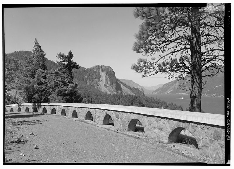
Hood River County Oregon (Historic Districts) has 6 places on the National Register of Historic Places including 3 places of National significance and 3 places of Statewide significance. Significant places include Barlow Road, Columbia River Highway Historic District, Columbia River Highway Historic District, Cloud Cap-Tilly Jane Recreation Area Historic District and Mt. Hood Railroad Linear Historic District.

Some of the country's most noteable architects helped create the Hood River County places including Oregon State Highway Department and Joseph West. Prominent architectural styles found in Hood River Country are .

Barlow Road (added 1992 - - #92000334)
Also known as Oregon Trail;See Also:Laurel Hill Segment, Barlow Road Histo
Roughly, N of Salmon and White Rivers from Rhododendron to SW of Wamic, Mt. Hood NF , Government Camp
Werewombat, CC BY-SA 3.0, via Wikimedia Commons
Historic Significance:
Event
Area of Significance:
Transportation, Exploration/Settlement
Period of Significance:
1900-1924, 1875-1899, 1850-1874, 1825-1849
Owner:
Local, Federal, Private
Historic Function:
Funerary, Transportation
Historic Sub-function:
Cemetery, Graves/Burials, Road-Related
Current Function:
Funerary, Transportation
Current Sub-function:
Cemetery, Graves/Burials, Road-Related
Cloud Cap-Tilly Jane Recreation Area Historic District (added 1981 - - #81000485)
Also known as See Also:Cloud Cap Inn
S of Parkdale , Parkdale
Werewombat, Public domain, via Wikimedia Commons
Historic Significance:
Event, Architecture/Engineering
Architect, builder, or engineer:
Unknown
Architectural Style:
Other
Area of Significance:
Exploration/Settlement, Architecture, Transportation
Period of Significance:
1900-1924, 1875-1899
Owner:
Federal
Historic Function:
Domestic
Historic Sub-function:
Camp, Hotel
Current Function:
Landscape, Recreation And Culture
Current Sub-function:
Park
Columbia River Highway Historic District (added 1983 - - #83004168)
Roughly bounded by the Sandy River Bridge, Troutdale, Multnomah County on the West, the Chenoweth Creek Bridge, etc. , Hood River
NE2, Public domain, via Wikimedia Commons
Historic Significance:
Event, Architecture/Engineering
Architect, builder, or engineer:
Oregon State Highway Department
Area of Significance:
Engineering, Transportation
Period of Significance:
1900-1924
Owner:
Mixed
Historic Function:
Transportation
Historic Sub-function:
Road-Related
Current Function:
Landscape, Transportation
Current Sub-function:
Park, Road-Related
Columbia River Highway Historic District (added 1983 - - #83004168)
Roughly bounded by the Sandy River Bridge, Troutdale, Multnomah County on the West, the Chenoweth Creek Bridge, etc. , Cascade Locks
NE2, Public domain, via Wikimedia Commons
Historic Significance:
Event, Architecture/Engineering
Architect, builder, or engineer:
Oregon State Highway Department
Area of Significance:
Engineering, Transportation
Period of Significance:
1900-1924
Owner:
Mixed
Historic Function:
Transportation
Historic Sub-function:
Road-Related
Current Function:
Landscape, Transportation
Current Sub-function:
Park, Road-Related
Mt. Hood Railroad Linear Historic District (added 1994 - - #93001507)
Mt. Hood RR right-of-way from Hood River to Parkdale , Hood River
Howcheng, Public domain, via Wikimedia Commons
Historic Significance:
Event
Area of Significance:
Industry, Agriculture, Transportation
Period of Significance:
1925-1949, 1900-1924
Owner:
Private
Historic Function:
Transportation
Historic Sub-function:
Rail-Related
Current Function:
Transportation
Current Sub-function:
Rail-Related
Mt. Hood Railroad Linear Historic District (added 1994 - - #93001507)
Mt. Hood RR right-of-way from Hood River to Parkdale , Parkdale
Howcheng, Public domain, via Wikimedia Commons
Historic Significance:
Event
Area of Significance:
Industry, Agriculture, Transportation
Period of Significance:
1925-1949, 1900-1924
Owner:
Private
Historic Function:
Transportation
Historic Sub-function:
Rail-Related
Current Function:
Transportation
Current Sub-function:
Rail-Related
Return to Top
Select a Different Oregon County (map)
Baker
Benton
Clackamas
Clatsop
Columbia
Coos
Curry
Deschutes
Douglas
Gilliam
Grant
Harney
Hood River
Jackson
Josephine
Klamath
Lake
Lane
Lincoln
Linn
Malheur
Marion
Multnomah
Polk
Umatilla
Union
Wallowa
Wasco
Washington
Yamhill
Select a Different State (map)
Alabama
Alaska
Arizona
Arkansas
California
Colorado
Connecticut
Delaware
District Of Columbia
Florida
Georgia
Hawaii
Idaho
Illinois
Indiana
Iowa
Kansas
Kentucky
Louisiana
Maine
Maryland
Massachusetts
Michigan
Minnesota
Mississippi
Missouri
Montana
Nebraska
Nevada
New Hampshire
New Jersey
New Mexico
New York
North Carolina
North Dakota
Ohio
Oklahoma
Oregon
Pennsylvania
Rhode Island
South Carolina
South Dakota
Tennessee
Texas
Utah
Vermont
Virginia
Washington
West Virginia
Wisconsin
Wyoming
Return to Home Page