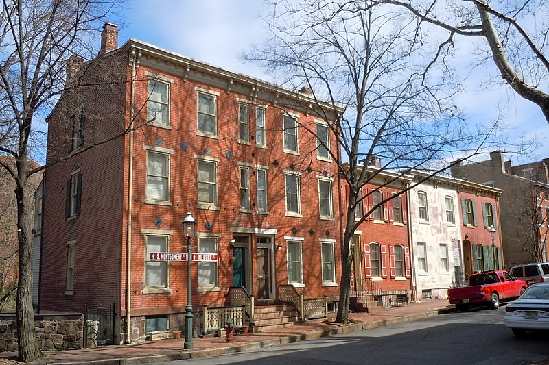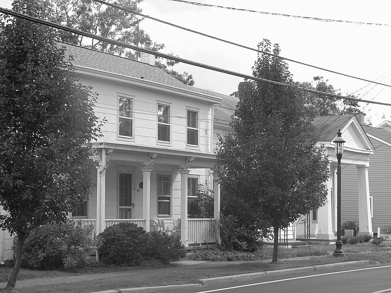
New Jersey - Mercer County - Historic Districts
Mercer County New Jersey (Historic Districts) has 24 places on the National Register of Historic Places including 1 place of National significance and 4 places of Statewide significance. Significant places include Lawrenceville School, Delaware and Raritan Canal, Princeton Battlefield Historic District (Boundary Increase), State House District and State House Historic District (Boundary Increase).

Several famous people are associated with these Mercer County historic places including HEnry Greenland and Thornton Wilder.

Some of the country's most noteable architects helped create the Mercer County places including Fredick Law Olmsted, Peabody & Stearns, John Notman, Hugh A. Kelly, J. Osborne Hunt, Frederick Law Olmstead, Pennington Satterthwaite, Howard Russell Butler and Eldridge G. Weir. Prominent architectural styles found in Mercer Country are Late Victorian, Colonial and Federal.

Bear Tavern Road--Jacob's Creek Crossing Rural Historic District (added 2011 - - #11000872)
Bear Tavern Rd. & Jacobs Creek Rd. (Hopewell & Ewing Townships), Somerset
KLOTZ, CC BY-SA 3.0, via Wikimedia Commons
Historic Significance:
Event, Architecture/Engineering
Architectural Style:
Georgian, Federal
Area of Significance:
Architecture, Invention, Transportation, Engineering, Military, Agriculture
Period of Significance:
1925-1949, 1900-1924, 1875-1899, 1850-1874, 1825-1849, 1800-1824, 1750-1799, 1700-1749
Berkeley Square Historic District (added 1980 - - #80002499)
Roughly bounded by W. State St., Parkside, Riverside, and Overbrook Aves. , Trenton
Smallbones, CC0, via Wikimedia Commons
Historic Significance:
Architecture/Engineering
Architect, builder, or engineer:
Weir,Eldridge G.
Architectural Style:
Colonial Revival, Bungalow/Craftsman, Late Victorian
Area of Significance:
Architecture, Community Planning And Development
Period of Significance:
1900-1924, 1875-1899
Owner:
Private
Historic Function:
Domestic
Historic Sub-function:
Single Dwelling
Current Function:
Domestic
Current Sub-function:
Multiple Dwelling, Single Dwelling
Delaware and Raritan Canal (added 1973 - - #73001105)
Follows the Delaware River to Trenton, then E to New Brunswick , Trenton
Zeete, CC BY-SA 3.0, via Wikimedia Commons
Historic Significance:
Event, Architecture/Engineering
Architect, builder, or engineer:
Unknown
Architectural Style:
No Style Listed
Area of Significance:
Transportation, Engineering, Commerce
Period of Significance:
1900-1924, 1875-1899, 1850-1874, 1825-1849
Owner:
State
Historic Function:
Domestic, Transportation
Historic Sub-function:
Single Dwelling, Water-Related
Current Function:
Domestic, Landscape
Current Sub-function:
Park, Single Dwelling
Harbourton Historic District (added 1974 - - #74001167)
Jct. of Harbourton/Rocktown Rd. and Harbourton/Mt. Airy Rd. , Harbourton
KLOTZ, CC BY-SA 3.0, via Wikimedia Commons
Historic Significance:
Architecture/Engineering
Architect, builder, or engineer:
Unknown
Architectural Style:
No Style Listed
Area of Significance:
Architecture
Period of Significance:
1825-1849, 1800-1824, 1750-1799
Owner:
Private
Historic Function:
Commerce/Trade, Domestic, Religion
Historic Sub-function:
Department Store, Religious Structure, Single Dwelling
Current Function:
Domestic, Religion
Current Sub-function:
Religious Structure, Single Dwelling
Jugtown Historic District (added 1987 - - #86003670)
Nassau and Harrison Sts., Harrison St. N, and Evelyn Pl. , Princeton Borough
Smallbones, CC0, via Wikimedia Commons
Historic Significance:
Event, Architecture/Engineering
Architect, builder, or engineer:
Unknown
Architectural Style:
Early Republic, Colonial Revival, Colonial
Area of Significance:
Education, Architecture, Commerce
Period of Significance:
1900-1924, 1825-1849, 1750-1799
Owner:
Private
Historic Function:
Commerce/Trade, Domestic
Historic Sub-function:
Single Dwelling
Current Function:
Domestic
Current Sub-function:
Single Dwelling
Kingston Mill Historic District (added 1986 - - #86000707)
Roughly bounded by Herrontown, River, Princeton-Kingston Rds., and lots W of Princeton Twp. , Princeton
Zeete, CC BY-SA 4.0, via Wikimedia Commons
Historic Significance:
Event, Person, Architecture/Engineering
Architect, builder, or engineer:
Unknown
Architectural Style:
Federal, Colonial, Late Victorian
Historic Person:
Greenland,HEnry
Area of Significance:
Exploration/Settlement, Engineering, Transportation, Industry
Period of Significance:
1875-1899, 1850-1874, 1825-1849, 1800-1824, 1750-1799, 1700-1749, 1650-1699
Owner:
Private, Local
Historic Function:
Agriculture/Subsistence, Domestic, Industry/Processing/Extraction
Historic Sub-function:
Agricultural Outbuildings, Manufacturing Facility, Secondary Structure, Single Dwelling
Current Function:
Agriculture/Subsistence, Domestic
Current Sub-function:
Agricultural Outbuildings, Single Dwelling
Lake Carnegie Historic District (added 1990 - - #90001000)
Roughly bounded by Lake Carnegie shoreline from Conrail bridge at W end to dam W of Kingston at E end , Princeton
TheCatalyst31, Public domain, via Wikimedia Commons
Historic Significance:
Event
Area of Significance:
Landscape Architecture, Entertainment/Recreation
Period of Significance:
1925-1949, 1900-1924
Owner:
Private, State, Local
Historic Function:
Recreation And Culture, Transportation
Historic Sub-function:
Outdoor Recreation, Road-Related, Sport Facility
Current Function:
Recreation And Culture, Transportation
Current Sub-function:
Outdoor Recreation, Road-Related, Sport Facility
Lawrence Township Historic District (added 1972 - - #72000799)
Also known as See Also:Lawrenceville School
Lawrenceville and vicinity N, including both sides of U.S. 206 , Lawrenceville
Smallbones, Public domain, via Wikimedia Commons
Historic Significance:
Event, Architecture/Engineering, Person
Architect, builder, or engineer:
Olmstead,Frederick Law, Peabody & Stearns
Architectural Style:
Mid 19th Century Revival, Colonial, Federal
Historic Person:
Wilder,Thornton
Area of Significance:
Transportation, Literature, Architecture, Landscape Architecture, Military
Period of Significance:
1925-1949, 1875-1899, 1850-1874, 1825-1849, 1800-1824, 1750-1799
Owner:
Private
Historic Function:
Domestic, Education
Historic Sub-function:
School, Single Dwelling
Current Function:
Domestic, Education
Current Sub-function:
School, Single Dwelling
Lawrenceville School (added 1986 - - #86000158)
Also known as Lawrenceville School National Historic Landmark;See Also:Law
Main St. , Lawrenceville
Daderot, CC BY-SA 3.0, via Wikimedia Commons
Historic Significance:
Architecture/Engineering
Architect, builder, or engineer:
Olmsted,Fredick Law, Peabody & Stearns
Architectural Style:
Other, Romanesque, Queen Anne
Area of Significance:
Architecture
Period of Significance:
1875-1899
Owner:
Private
Historic Function:
Education
Historic Sub-function:
Educational Related Housing, School
Current Function:
Education
Current Sub-function:
Educational Related Housing, School
Mill Hill Historic District (added 1977 - - #77000880)
Also known as See Also:Douglass House;Mercer Street Friends Center
Roughly bounded by Clay, Jackson, Front, Market, Broad, and Greenwood Sts. , Trenton
Smallbones, CC0, via Wikimedia Commons
Historic Significance:
Event, Architecture/Engineering
Architect, builder, or engineer:
Unknown
Architectural Style:
Greek Revival, Queen Anne, Second Empire
Area of Significance:
Military, Architecture, Commerce
Period of Significance:
1875-1899, 1850-1874, 1825-1849, 1750-1799
Owner:
Private, Local
Historic Function:
Commerce/Trade, Defense, Domestic, Industry/Processing/Extraction
Historic Sub-function:
Battle Site, Business, Manufacturing Facility, Single Dwelling
Current Function:
Domestic
Current Sub-function:
Single Dwelling
Mountain Avenue Historic District (added 1995 - - #94001604)
73--143 Mountain Ave. , Princeton
KLOTZ, CC BY-SA 3.0, via Wikimedia Commons
Historic Significance:
Event, Architecture/Engineering
Architectural Style:
Late 19th And Early 20th Century American Movements, Late 19th And 20th Century Revivals, Late Victorian
Area of Significance:
Community Planning And Development, Architecture
Period of Significance:
1925-1949, 1900-1924, 1875-1899, 1850-1874, 1825-1849
Owner:
Private
Historic Function:
Agriculture/Subsistence, Domestic
Historic Sub-function:
Agricultural Fields, Secondary Structure, Single Dwelling
Current Function:
Domestic
Current Sub-function:
Secondary Structure, Single Dwelling
Phillips, Joseph, Farm (added 1977 - - #77000879)
Also known as Howell Farm
N of Titusville on Hunter Rd. , Titusville
KLOTZ, CC BY-SA 3.0, via Wikimedia Commons
Historic Significance:
Event, Architecture/Engineering
Architect, builder, or engineer:
Unknown
Architectural Style:
No Style Listed
Area of Significance:
Agriculture, Architecture
Period of Significance:
1925-1949, 1900-1924, 1875-1899, 1850-1874, 1800-1824, 1700-1749
Owner:
Local
Historic Function:
Domestic
Historic Sub-function:
Secondary Structure, Single Dwelling
Current Function:
Domestic, Recreation And Culture
Current Sub-function:
Museum, Secondary Structure, Single Dwelling, Sport Facility
Pleasant Valley Historic District (added 1991 - - #91000676)
Also known as See Also:Phillips, Joseph, Farm
Centered on jct. of Pleasant Valley Rd. with Woodens Ln. and Hunter Rd., Hopewell and West Amwell Twps. , Lambertville
KLOTZ, CC BY-SA 3.0, via Wikimedia Commons
Historic Significance:
Information Potential, Architecture/Engineering, Event
Architect, builder, or engineer:
Unknown
Architectural Style:
Other, Georgian
Area of Significance:
Historic - Non-Aboriginal, Exploration/Settlement, Agriculture, Architecture
Cultural Affiliation:
Early American
Period of Significance:
1925-1949, 1900-1924, 1875-1899, 1850-1874, 1825-1849, 1800-1824, 1750-1799, 1700-1749
Owner:
Private, Local
Historic Function:
Agriculture/Subsistence
Historic Sub-function:
Agricultural Fields, Agricultural Outbuildings, Animal Facility, Processing
Current Function:
Agriculture/Subsistence, Domestic
Current Sub-function:
Agricultural Fields, Agricultural Outbuildings, Animal Facility, Single Dwelling
Princessville Inn (added 1982 - - #80002497)
E of Lawrenceville at 3510 Princeton Pike , Lawrenceville
send us a photo to share
Historic Significance:
Event
Area of Significance:
Politics/Government
Period of Significance:
1875-1899, 1850-1874, 1800-1824
Owner:
Local
Historic Function:
Domestic
Historic Sub-function:
Hotel
Current Function:
Vacant/Not In Use
Princeton Battlefield Historic District (Boundary Increase) (added 1989 - - #89000761)
Also known as Princeton Battlefield--Stony Brook Village Historic District
Roughly Quaker Rd. from Stockton Rd. to Stony Brook , Princeton
send us a photo to share
Historic Significance:
Event
Area of Significance:
Military, Exploration/Settlement
Period of Significance:
1750-1799, 1700-1749, 1650-1699
Owner:
Private
Historic Function:
Defense, Domestic
Historic Sub-function:
Battle Site, Single Dwelling
Current Function:
Domestic, Education
Current Sub-function:
Research Facility, Single Dwelling
Princeton Historic District (added 1975 - - #75001143)
Also known as See Also:Nassau Hall;Henry,Joseph,House;Morven;President`s H
Irregular pattern between Lytle St. and Haslet Ave. from Lovers Lane to Olden Sts. , Princeton
Elisa.rolle, CC BY-SA 3.0, via Wikimedia Commons
Historic Significance:
Person, Event, Architecture/Engineering
Architect, builder, or engineer:
Multiple
Architectural Style:
Mid 19th Century Revival, Late Victorian, Colonial
Historic Person:
Multiple
Significant Year:
1783, 1825, 1747
Area of Significance:
Transportation, Education, Politics/Government, Invention, Agriculture, Architecture, Landscape Architecture, Literature, Commerce, Communications
Period of Significance:
1825-1849, 1750-1799, 1700-1749
Owner:
Private, Local
Historic Function:
Commerce/Trade, Domestic, Education, Funerary, Transportation
Historic Sub-function:
Cemetery, College, Rail-Related, Water-Related
Current Function:
Commerce/Trade, Domestic, Education, Funerary, Recreation And Culture, Transportation
Current Sub-function:
Cemetery, College, Monument/Marker, Rail-Related
Riverview Cemetery (added 2017 - - #100000810)
870 Centre Street, Trenton
KLOTZPLATE, CC BY-SA 4.0, via Wikimedia Commons
Historic Significance:
Event, Architecture/Engineering
Architectural Style:
Art Deco, Mixed (More Than 2 Styles From Different Periods)
Area of Significance:
Landscape Architecture
Period of Significance:
1858-1950 AD
Roebling's, John A., Sons Company, Trenton N.J., Block 3 (added 2012 - - #12000528)
Bounded by Hamilton Ave., Clark, Elmer, & E. Canal Sts., Trenton
Djkeddie, CC BY-SA 4.0, via Wikimedia Commons
Historic Significance:
Event, Architecture/Engineering, Person
Architectural Style:
Italianate, International Style
Historic Person:
Roebling, Charles G.
Area of Significance:
Architecture, Engineering, Industry, Transportation
Period of Significance:
1925-1949, 1900-1924
State House District (added 1976 - - #76001161)
Also known as See Also:State House Historic District (Boundary Increase)
Roughly bounded by Capitol Plaza, Willow, State and Lafayette Sts. , Trenton
Smallbones, CC0, via Wikimedia Commons
Historic Significance:
Architecture/Engineering, Event
Architect, builder, or engineer:
Notman,John,et al.
Architectural Style:
Greek Revival, Beaux Arts, Late Victorian
Area of Significance:
Military, Politics/Government, Architecture
Period of Significance:
1875-1899, 1825-1849, 1750-1799
Owner:
Private, State
Historic Function:
Commerce/Trade, Domestic, Education, Government
Historic Sub-function:
Capitol, College, Government Office, Single Dwelling
Current Function:
Commerce/Trade, Domestic, Education, Government
Current Sub-function:
Capitol, College, Government Office, Multiple Dwelling
State House Historic District (Boundary Increase) (added 1992 - - #92000295)
Also known as State House Annex;See Also:State House District
W. State St. S side, W of New Jersey State House , Trenton
send us a photo to share
Historic Significance:
Architecture/Engineering, Event
Architect, builder, or engineer:
Kelly,Hugh A., Hunt,J. Osborne
Architectural Style:
Classical Revival
Area of Significance:
Politics/Government, Architecture
Period of Significance:
1925-1949
Owner:
State
Historic Function:
Education, Government, Recreation And Culture
Historic Sub-function:
Courthouse, Government Office, Library, Museum
Current Function:
Government
Current Sub-function:
Government Office
Stockton Street Historic District (added 2005 - - #05001331)
126-136 Stockton St., 219-237 Rogers Ave. , Hightstown
Rcbutcher, CC BY-SA 3.0, via Wikimedia Commons
Historic Significance:
Architecture/Engineering, Event
Architectural Style:
Queen Anne, Gothic
Area of Significance:
Transportation, Architecture
Period of Significance:
1900-1924, 1875-1899, 1850-1874, 1825-1849
Owner:
Local, Private
Historic Function:
Domestic, Recreation And Culture, Religion
Historic Sub-function:
Monument/Marker, Religious Structure, Single Dwelling
Current Function:
Domestic, Recreation And Culture, Religion
Current Sub-function:
Monument/Marker, Religious Structure, Single Dwelling
Titusville Historic District (added 1983 - - #83001604)
River Dr. , Titusville
KLOTZ, CC BY-SA 3.0, via Wikimedia Commons
Historic Significance:
Architecture/Engineering, Event
Architectural Style:
Other, Greek Revival, Late Victorian
Area of Significance:
Architecture, Transportation, Industry, Religion
Period of Significance:
1850-1874, 1825-1849
Owner:
Private
Historic Function:
Commerce/Trade, Domestic, Industry/Processing/Extraction, Transportation
Historic Sub-function:
Manufacturing Facility, Rail-Related, Single Dwelling, Specialty Store
Current Function:
Commerce/Trade, Domestic, Education, Religion
Current Sub-function:
Religious Structure, School, Single Dwelling
Trenton Ferry Historic District (added 2013 - - #13000355)
Roughly bounded by S. Broad & Federal Sts., Delaware R. & Amtrak NW Corridor, Trenton
KLOTZ, CC BY-SA 3.0, via Wikimedia Commons
Historic Significance:
Event, Architecture/Engineering, Information Potential
Architectural Style:
Early Republic, Late Victorian
Area of Significance:
Architecture, Historic - Non-Aboriginal, Commerce, Community Planning And Development, Transportation
Period of Significance:
1925-1949, 1900-1924, 1875-1899, 1850-1874, 1825-1849, 1800-1824, 1750-1799, 1700-1749
Windsor Historic District (added 1992 - - #88001710)
Roughly bounded by properties along Main St. and Church St. , Windsor
Cesherman, CC BY-SA 3.0, via Wikimedia Commons
Historic Significance:
Event
Area of Significance:
Commerce, Transportation, Exploration/Settlement
Period of Significance:
1925-1949, 1900-1924, 1875-1899, 1850-1874, 1825-1849
Owner:
Private, Local
Historic Function:
Commerce/Trade, Domestic, Religion
Historic Sub-function:
Religious Structure, Single Dwelling
Current Function:
Commerce/Trade, Domestic, Religion
Current Sub-function:
Religious Structure, Single Dwelling
Return to Top
Select a Different New Jersey County (map)
Atlantic
Bergen
Burlington
Camden
Cape May
Cumberland
Essex
Gloucester
Hudson
Hunterdon
Mercer
Middlesex
Monmouth
Morris
Ocean
Passaic
Salem
Somerset
Sussex
Union
Warren
Select a Different State (map)
Alabama
Alaska
Arizona
Arkansas
California
Colorado
Connecticut
Delaware
District Of Columbia
Florida
Georgia
Hawaii
Idaho
Illinois
Indiana
Iowa
Kansas
Kentucky
Louisiana
Maine
Maryland
Massachusetts
Michigan
Minnesota
Mississippi
Missouri
Montana
Nebraska
Nevada
New Hampshire
New Jersey
New Mexico
New York
North Carolina
North Dakota
Ohio
Oklahoma
Oregon
Pennsylvania
Rhode Island
South Carolina
South Dakota
Tennessee
Texas
Utah
Vermont
Virginia
Washington
West Virginia
Wisconsin
Wyoming
Return to Home Page